


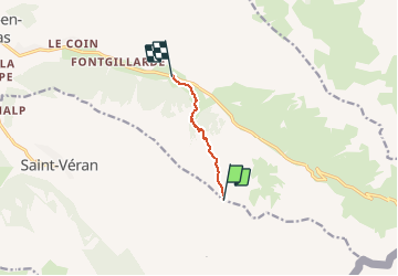
20190210 CAF Ski de rando - Descente Col Longet

motardes04
User

Length
4.4 km

Max alt
2705 m

Uphill gradient
3 m
Km-Effort
6.7 km

Min alt
2025 m

Downhill gradient
676 m
Boucle
No
Creation date :
2019-04-02 09:39:52.177
Updated on :
2019-04-02 09:39:52.177
1h51
Difficulty : Unknown

FREE GPS app for hiking
 SityTrail
IGN / Geographical institutes
SityTrail Plus
The world is yours!
About
Trail Snowshoes of 4.4 km to be discovered at Provence-Alpes-Côte d'Azur, Hautes-Alpes, Molines-en-Queyras. This trail is proposed by motardes04.
Positioning
Country:
France
Region :
Provence-Alpes-Côte d'Azur
Department/Province :
Hautes-Alpes
Municipality :
Molines-en-Queyras
Location:
Unknown
Start:(Dec)
Start:(UTM)
335191 ; 4950790 (32T) N.
Comments