


18.9 km | 22 km-effort


User


FREE GPS app for hiking
 SityTrail
IGN / Geographical institutes
SityTrail World
The world is yours!
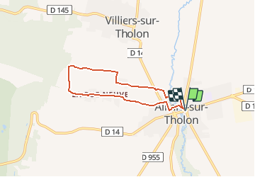
Trail Walking of 5.6 km to be discovered at Bourgogne-Franche-Comté, Yonne, Montholon. This trail is proposed by tracegps.
Circuit proposé par Office du Tourisme d’Aillant-sur-Tholon. Par prudence, évitez de pratiquer ce circuit les jours de chasse. Retrouvez le circuit et son descriptif sur le site de l’Office du Tourisme d’Aillant-sur-Tholon. Ce circuit a été numérisé par les randonneurs du CODEPEM. Merci à Jean-Marie.

Walking

Walking
Walking
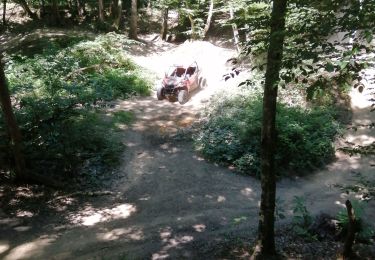
Quad

Other activity

Walking
Other activity
Walking

Electric bike