Trail Walking Bercenay-en-Othe - Circuit de Bercenay en Othe - Photo

Circuit de Bercenay en Othe

 tracegps
tracegps

User

© OpenStreetMap contributors
Length
Length
10.1 km
Max alt
Max alt
247 m
Uphill gradient
Uphill gradient
196 m
Km-Effort
Km-Effort  
12.7 km
Min alt
Min alt
157 m
Downhill gradient
Downhill gradient
197 m
Boucle
Boucle
Yes
Creation date :
2014-12-10 00:00:00.0
Updated on :
2014-12-10 00:00:00.0

(0 Reviews)

Walking
Walking
2h30
Difficulty : Medium

Scan this QR Code to open this trail in the SityTrail application

FREE GPS app for hiking

Logo SityTrail SityTrail

IGN / Geographical institutes

Download SityTrail from the App Store Download SityTrail from Google Play

Logo SityTrail SityTrail World

The world is yours!

Download SityTrail from the App Store Download SityTrail from Google Play Download SityTrail on Huawei AppGallery

About

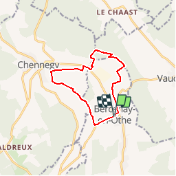
Trail Walking of 10.1 km to be discovered at Grand Est, Aube, Bercenay-en-Othe. This trail is proposed by tracegps.

Description

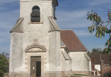
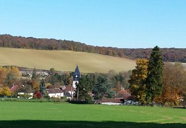
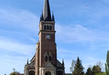
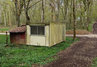
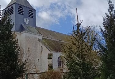
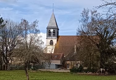
Circuit proposé par l'Office de Tourisme du Pays d’Othe. Départ de la place de la salle des fêtes de Bercenay-en-Othe. Situé en face de l'église, le lavoir, datant de 1843 a été construit dans l'ancien jardin du presbythère. C'est un octogone irrgulier en briques recouvert d'un toit en ardoises losangées, soutenu par des piliers qui poncteunt chaque pan de l'ocotogone. A la sortie de Perrière, on passe près d'un rendez vous de chasse du général Rambourg, datant du début du XIXème siècle, un batiment sans étage, tout en hauteur. Retrouvez ce circuit sur le site de l’Office de Tourisme du Pays d’Othe. Ce circuit a été numérisé par les randonneurs du CODEPEM. Merci à Jean-Marie.

Elevation profile

Photos

Positioning

Country:
France
Region :
Grand Est
Department/Province :
Aube
Municipality :
Bercenay-en-Othe
Location:
Unknown
Start:(UTM)
566209 ; 5339828 (31U) N.

Trails nearby

Trail Walking Prugny - Montbernange - Photo
Walking
FPortier

Walking

Medium
(1)
Prugny, Grand Est, Aube, France
9.4 km | 12 km-effort
2h 19min
Yes
Trail Walking Chennegy - Le chemin du patrimoine du Valdreux - Photo
Walking
gildascb

Walking

Very easy
(1)
Chennegy, Grand Est, Aube, France
8.6 km | 10.5 km-effort
1h 57min
Yes
Trail Walking Vauchassis - Randonnée Bucey 23 04 2024 - Photo
Walking
FPortier

Walking

Difficult
Vauchassis, Grand Est, Aube, France
10.5 km | 13.4 km-effort
3h 5min
Yes
Trail Electric bike Vauchassis - Balade VAE Pays d Othe - Photo
Electric bike
FPortier

Electric bike

Very easy
Vauchassis, Grand Est, Aube, France
56 km | 66 km-effort
5h 15min
Yes
Trail Walking Vauchassis - Balade Forêt communale de Vauchassis - Photo
Walking
FPortier

Walking

Medium
Vauchassis, Grand Est, Aube, France
7.5 km | 9.1 km-effort
2h 26min
Yes
Trail Walking Vauchassis - Vauchassis Bercenay Vauchassis - Photo
Walking
FPortier

Walking

Difficult
Vauchassis, Grand Est, Aube, France
10.3 km | 13 km-effort
3h 2min
Yes
Trail Walking Vauchassis - Randonnée Grands Bois Vauchassis - Photo
Walking
FPortier

Walking

Medium
Vauchassis, Grand Est, Aube, France
9.7 km | 12 km-effort
2h 51min
Yes
Trail Electric bike Vauchassis - Balade VAE Pays d'Othe - Photo
Electric bike
FPortier

Electric bike

Medium
Vauchassis, Grand Est, Aube, France
46 km | 56 km-effort
3h 38min
Yes
Trail Walking Chennegy - Randonnée à Chennegy - Photo
Walking
FPortier

Walking

Difficult
Chennegy, Grand Est, Aube, France
10.6 km | 12.4 km-effort
3h 5min
Yes


Close
My subscriptions