


anderluesfinal140219

andre.rochet.ar
User
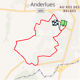

Length
7.3 km

Max alt
204 m

Uphill gradient
44 m
Km-Effort
7.9 km

Min alt
181 m

Downhill gradient
45 m
Boucle
Yes
Creation date :
2019-04-29 19:01:23.241
Updated on :
2019-04-29 19:01:23.241
2h06
Difficulty : Very easy

FREE GPS app for hiking
 SityTrail
IGN / Geographical institutes
SityTrail Plus
The world is yours!
About
Trail Nordic walking of 7.3 km to be discovered at Wallonia, Hainaut, Anderlues. This trail is proposed by andre.rochet.ar.
Positioning
Country:
Belgium
Region :
Wallonia
Department/Province :
Hainaut
Municipality :
Anderlues
Location:
Anderlues
Start:(Dec)
Start:(UTM)
590884 ; 5583762 (31U) N.
Comments