


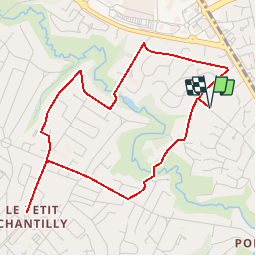
Le Cens - circuit 2 d'Orvault

tracegps
User


1h10
Difficulty : Easy

FREE GPS app for hiking
 SityTrail
IGN / Geographical institutes
SityTrail Plus
The world is yours!
About
Trail Walking of 4.7 km to be discovered at Pays de la Loire, Loire-Atlantique, Orvault. This trail is proposed by tracegps.
Description
Circuit proposé par la mairie d’Orvault. Départ du parking de la salle Elia, rue de la Mulonnière. Retrouvez le circuit sur le site de la mairie. Ce circuit a été numérisé par les randonneurs du CODEPEM. Merci à Jean-Marie.
Photos

Positioning
Comments