Trail Cycle Camurac - CCS FFC Aude en Pyrénées - Circuit n°19 - Camurac - Photo

CCS FFC Aude en Pyrénées - Circuit n°19 - Camurac

 tracegps
tracegps

User

© OpenStreetMap contributors
Length
Length
59 km
Max alt
Max alt
1679 m
Uphill gradient
Uphill gradient
1684 m
Km-Effort
Km-Effort  
81 km
Min alt
Min alt
742 m
Downhill gradient
Downhill gradient
1685 m
Boucle
Boucle
Yes
Creation date :
2014-12-10 00:00:00.0
Updated on :
2014-12-10 00:00:00.0

(0 Reviews)

Cycle
Cycle
3h30
Difficulty : Difficult

Scan this QR Code to open this trail in the SityTrail application

FREE GPS app for hiking

Logo SityTrail SityTrail

IGN / Geographical institutes

Download SityTrail from the App Store Download SityTrail from Google Play

Logo SityTrail SityTrail World

The world is yours!

Download SityTrail from the App Store Download SityTrail from Google Play Download SityTrail on Huawei AppGallery

About

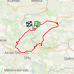
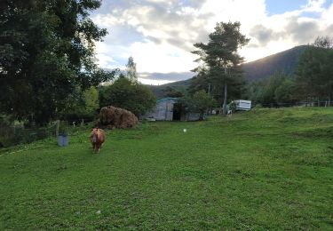
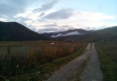
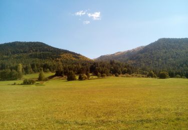
Trail Cycle of 59 km to be discovered at Occitania, Aude, Camurac. This trail is proposed by tracegps.

Description

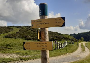
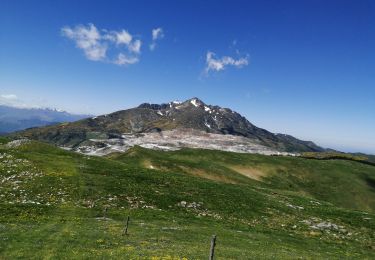
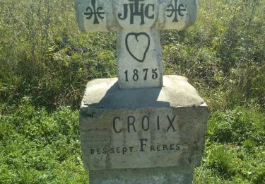
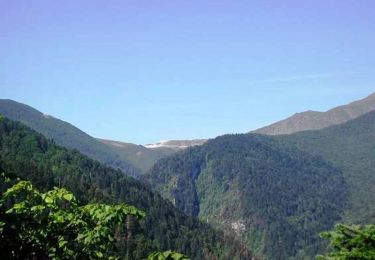
Cette boucle relativement courte permet de découvrir le très difficile col du Pradel qui vous laissera un grand souvenir « cycliste » : une route étroite en forêt longeant le magnifique torrent du Rébenty, des pourcentages parfois redoutables, mais un panorama superbe au sommet. Attention à la descente très technique sur une route souvent occupée par des animaux. Retour par le col de Chioula plus difficile qu’il n’y paraît.

Elevation profile

Photos

Positioning

Country:
France
Region :
Occitania
Department/Province :
Aude
Municipality :
Camurac
Location:
Unknown
Start:(UTM)
411512 ; 4738809 (31T) N.

Trails nearby

Trail Walking Prades - La Chioula Orlu GR107 le chemins des Bonshommes - Photo
Walking
tercla

Walking

Difficult
Prades, Occitania, Ariège, France
18.7 km | 25 km-effort
6h 17min
No
Trail Walking Prades - Pic Fourcat Prades  - Photo
Walking
caccini

Walking

Medium
(1)
Prades, Occitania, Ariège, France
14 km | 25 km-effort
6h 52min
Yes
Trail Snowshoes Montaillou - Montaillou - Quercourt - Cassaula  - Photo
Snowshoes
meunier.ph.

Snowshoes

Easy
Montaillou, Occitania, Ariège, France
14 km | 24 km-effort
4h 21min
Yes
Trail Walking La Fajolle - La forêt de La Fajolle - Photo
Walking
c.chehere

Walking

Medium
La Fajolle, Occitania, Aude, France
15.5 km | 24 km-effort
4h 59min
Yes
Trail Walking Camurac - Les cretes de Camurac 2021 - Photo
Walking
c.chehere

Walking

Medium
Camurac, Occitania, Aude, France
14.3 km | 23 km-effort
5h 38min
Yes
Trail Walking Camurac - Les sept frères - Photo
Walking
c.chehere

Walking

Easy
Camurac, Occitania, Aude, France
15.5 km | 23 km-effort
5h 31min
Yes
Trail Walking Camurac - Tour du Boum - Photo
Walking
c.chehere

Walking

Easy
Camurac, Occitania, Aude, France
16.8 km | 23 km-effort
4h 0min
Yes
Trail Walking Camurac - les crêtes de Camurac - Photo
Walking
c.chehere

Walking

Medium
Camurac, Occitania, Aude, France
15.6 km | 24 km-effort
4h 30min
Yes
Trail Mountain bike Belcaire - Tour des châteaux du Pays Cathare - Belcaire - Puivert - Photo
Mountain bike
tracegps

Mountain bike

Very difficult
Belcaire, Occitania, Aude, France
57 km | 83 km-effort
3h 30min
No


Close
My subscriptions