


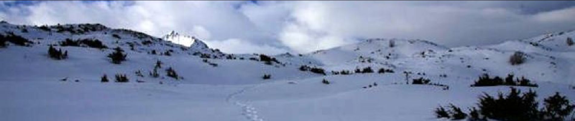
Le Turon d'Ompré en raquettes

tracegps
User
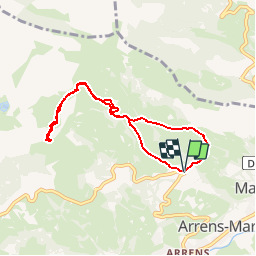

Length
7.3 km

Max alt
1502 m

Uphill gradient
456 m
Km-Effort
13.4 km

Min alt
1039 m

Downhill gradient
448 m
Boucle
Yes
Creation date :
2014-12-10 00:00:00.0
Updated on :
2014-12-10 00:00:00.0
3h40
Difficulty : Medium

FREE GPS app for hiking
 SityTrail
IGN / Geographical institutes
SityTrail Plus
The world is yours!
About
Trail Snowshoes of 7.3 km to be discovered at Occitania, Hautespyrenees, Arrens-Marsous. This trail is proposed by tracegps.
Description
Une randonnée en raquette pour monter au Turon d'Ompré au dessus d'Arrens depuis le Quartier Bretou par les Artigaus.
Photos

Positioning
Country:
France
Region :
Occitania
Department/Province :
Hautespyrenees
Municipality :
Arrens-Marsous
Location:
Unknown
Start:(Dec)
Start:(UTM)
727101 ; 4760846 (30T) N.
Comments