


cdf

VacheKiri67
User
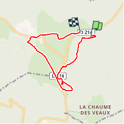

Length
6.5 km

Max alt
1103 m

Uphill gradient
165 m
Km-Effort
8.6 km

Min alt
999 m

Downhill gradient
142 m
Boucle
No
Creation date :
2019-02-24 20:01:22.364
Updated on :
2019-02-24 20:06:37.556
2h24
Difficulty : Very easy

FREE GPS app for hiking
 SityTrail
IGN / Geographical institutes
SityTrail Plus
The world is yours!
About
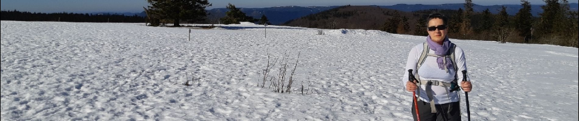
Trail On foot of 6.5 km to be discovered at Grand Est, Bas-Rhin, Le Hohwald. This trail is proposed by VacheKiri67.
Description
Faite le 17/02/2019 sous un soleil radieux.
Avec 30 à 50 cm de neige.
Photos


Positioning
Country:
France
Region :
Grand Est
Department/Province :
Bas-Rhin
Municipality :
Le Hohwald
Location:
Unknown
Start:(Dec)
Start:(UTM)
372594 ; 5363006 (32U) N.
Comments