Trail Walking Athis-Val-de-Rouvre - Rando botanique  - Ségrie Fontaine  - Photo

Rando botanique - Ségrie Fontaine

 tracegps
tracegps

User

© OpenStreetMap contributors
Length
Length
10.4 km
Max alt
Max alt
241 m
Uphill gradient
Uphill gradient
226 m
Km-Effort
Km-Effort  
13.4 km
Min alt
Min alt
100 m
Downhill gradient
Downhill gradient
229 m
Boucle
Boucle
Yes
Creation date :
2014-12-10 00:00:00.0
Updated on :
2014-12-10 00:00:00.0

(2 Reviews)

Walking
Walking
3h40
Difficulty : Medium

Scan this QR Code to open this trail in the SityTrail application

FREE GPS app for hiking

Logo SityTrail SityTrail

IGN / Geographical institutes

Download SityTrail from the App Store Download SityTrail from Google Play

Logo SityTrail SityTrail World

The world is yours!

Download SityTrail from the App Store Download SityTrail from Google Play Download SityTrail on Huawei AppGallery

About

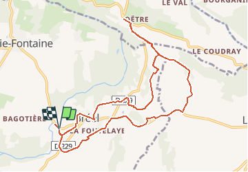
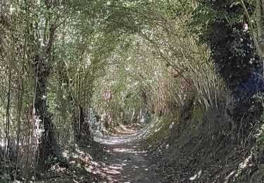
Trail Walking of 10.4 km to be discovered at Normandy, Orne, Athis-Val-de-Rouvre. This trail is proposed by tracegps.

Description

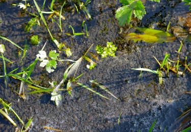
Rando botanique - Ségrie Fontaine "Le Moulin". La Suisse Normande abrite, grâce à la présence d'un maillage bocager bien préservé, une flore riche et variée. Ce patrimoine naturel inestimable est mis à l'honneur dans ce circuit botanique. Retrouvez les Coup de Cœur Randonnée dans l’Orne en Normandie.

Elevation profile

Photos

Positioning

Country:
France
Region :
Normandy
Department/Province :
Orne
Municipality :
Athis-Val-de-Rouvre
Location:
Bréel
Start:(UTM)
691120 ; 5409702 (30U) N.

Comments

Please log in to post a review or rate the element


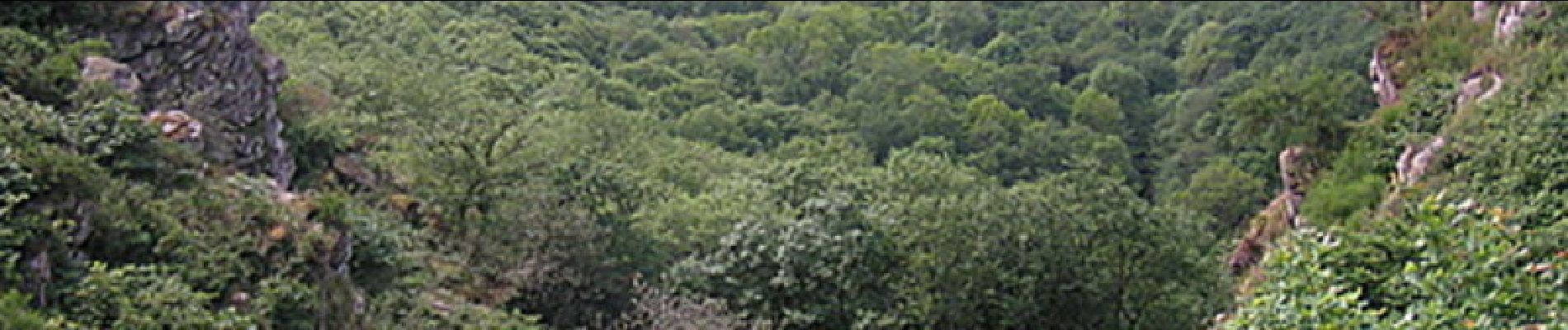
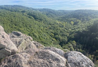
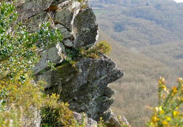
Certains morceaux du parcours sont inaccessibles. Sentiers ont disparu. Très beau parcours varié!


Trails nearby

Trail Walking Saint-Philbert-sur-Orne - Autour des roches d'oetre - Photo
Walking
phi14

Walking

Easy
(3)
Saint-Philbert-sur-Orne, Normandy, Orne, France
9.7 km | 12.4 km-effort
2h 30min
Yes
Trail Walking Saint-Philbert-sur-Orne - Roche d’oëtre sentier du Granite - Photo
Walking
zefreefly

Walking

Very easy
Saint-Philbert-sur-Orne, Normandy, Orne, France
10.1 km | 12.7 km-effort
2h 43min
Yes
Trail Walking Saint-Philbert-sur-Orne - Circuit des méandres  - Photo
Walking
JLPIERSON

Walking

Medium
Saint-Philbert-sur-Orne, Normandy, Orne, France
6.4 km | 8.4 km-effort
1h 54min
Yes
Trail Walking Ménil-Hubert-sur-Orne - De Rouvroy aux Roches d'Oetre par le sentier des Méandres  - Photo
Walking
Ecureuiltrailer

Walking

Medium
Ménil-Hubert-sur-Orne, Normandy, Orne, France
7.1 km | 9.3 km-effort
2h 1min
Yes
Trail On foot Athis-Val-de-Rouvre - Les Fontaines - Photo
On foot
PRO

On foot

Easy
Athis-Val-de-Rouvre, Normandy, Orne, France
5.7 km | 7.3 km-effort
1h 38min
Yes
Trail On foot Athis-Val-de-Rouvre - Sentier du granite - Photo
On foot
PRO

On foot

Easy
(1)
Athis-Val-de-Rouvre, Normandy, Orne, France
8.6 km | 11 km-effort
2h 30min
Yes
Trail On foot Saint-Philbert-sur-Orne - Entre Orne et Rouvre - Photo
On foot
PRO

On foot

Easy
Saint-Philbert-sur-Orne, Normandy, Orne, France
7.7 km | 10.3 km-effort
2h 19min
Yes
Trail On foot Le Mesnil-Villement - Tour du Pays de Falaise - Photo
On foot
PRO

On foot

Easy
Le Mesnil-Villement, Normandy, Calvados, France
8.6 km | 11.9 km-effort
2h 42min
No
Trail Walking Saint-Philbert-sur-Orne - Wikiloc Roche doetre (PVDB) - Photo
Walking
GUIDE
Peter.vdbergh

Walking

Medium
Saint-Philbert-sur-Orne, Normandy, Orne, France
8.3 km | 10.8 km-effort
2h 48min
Yes


Close
My subscriptions