Trail Cycle Saint-Mihiel - Aux portes de Saint-Mihiel - Circuit n° 6 - Photo

Aux portes de Saint-Mihiel - Circuit n° 6

 tracegps
tracegps

User

© OpenStreetMap contributors
Length
Length
41 km
Max alt
Max alt
398 m
Uphill gradient
Uphill gradient
556 m
Km-Effort
Km-Effort  
48 km
Min alt
Min alt
217 m
Downhill gradient
Downhill gradient
556 m
Boucle
Boucle
Yes
Creation date :
2014-12-10 00:00:00.0
Updated on :
2014-12-10 00:00:00.0

(0 Reviews)

Cycle
Cycle
2h19
Difficulty : Medium

Scan this QR Code to open this trail in the SityTrail application

FREE GPS app for hiking

Logo SityTrail SityTrail

IGN / Geographical institutes

Download SityTrail from the App Store Download SityTrail from Google Play

Logo SityTrail SityTrail World

The world is yours!

Download SityTrail from the App Store Download SityTrail from Google Play Download SityTrail on Huawei AppGallery

About

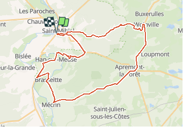
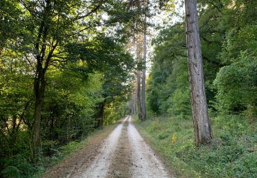
Trail Cycle of 41 km to be discovered at Grand Est, Meuse, Saint-Mihiel. This trail is proposed by tracegps.

Description

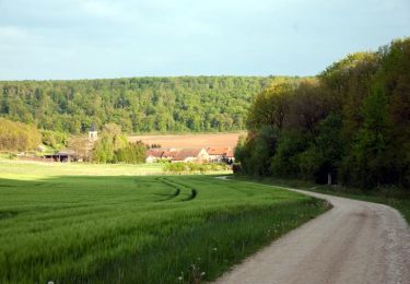
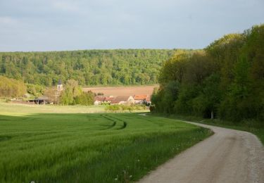
Ville-Porte du Parc Naturel Régional de Lorraine , St Mihiel et ses alentours offrent un relief vallonné mêlant plaines et forêt, canaux et rivières. Un circuit pour suivre les méandres de la Meuse et rejoindre le relief de Côtes. Départ de l’Office de Tourisme de St-Mihiel. Retrouvez ici le plan et descriptif du circuit. Vous pouvez obtenir le guide par courrier auprès du Parc Naturel Régional de Lorraine.

Elevation profile

Photos

Positioning

Country:
France
Region :
Grand Est
Department/Province :
Meuse
Municipality :
Saint-Mihiel
Location:
Unknown
Start:(UTM)
686229 ; 5418193 (31U) N.

Trails nearby

Trail Walking Saint-Mihiel - saillant de St-Mihiel - Photo
Walking
cath310

Walking

Difficult
(1)
Saint-Mihiel, Grand Est, Meuse, France
26 km | 32 km-effort
6h 51min
Yes
Trail Cycle Saint-Mihiel - La vallée de  la Meuse - St-Mihiel - Photo
Cycle
tracegps

Cycle

Medium
Saint-Mihiel, Grand Est, Meuse, France
38 km | 45 km-effort
2h 15min
Yes
Trail Mountain bike Saint-Mihiel - Le Saillant de Saint-Mihiel - Photo
Mountain bike
tracegps

Mountain bike

Medium
Saint-Mihiel, Grand Est, Meuse, France
20 km | 26 km-effort
2h 0min
Yes
Trail Walking Saint-Mihiel - Le Saillant de Saint-Mihiel - Photo
Walking
tracegps

Walking

Very difficult
Saint-Mihiel, Grand Est, Meuse, France
20 km | 26 km-effort
4h 4min
Yes
Trail Cycle Saint-Mihiel - Le vent des forêts - Saint Mihiel - Photo
Cycle
tracegps

Cycle

Medium
Saint-Mihiel, Grand Est, Meuse, France
42 km | 48 km-effort
2h 30min
Yes
Trail Cycle Saint-Mihiel - Aux portes du Parc Naturel Régional de Lorraine - Saint Mihiel - Photo
Cycle
tracegps

Cycle

Medium
Saint-Mihiel, Grand Est, Meuse, France
39 km | 45 km-effort
2h 0min
Yes
Trail Mountain bike Kœur-la-Petite - Koeur - version 2 - Photo
Mountain bike
tracegps

Mountain bike

Difficult
Kœur-la-Petite, Grand Est, Meuse, France
30 km | 35 km-effort
2h 30min
Yes
Trail Walking Saint-Mihiel - St Mihiel - forêt domaniale de Gaumont - Photo
Walking
g.chotel

Walking

Easy
Saint-Mihiel, Grand Est, Meuse, France
9.8 km | 12.1 km-effort
1h 55min
Yes
Trail Walking Dompcevrin - circuit du gros caillou Vdf - Photo
Walking
bohynm

Walking

Very easy
(1)
Dompcevrin, Grand Est, Meuse, France
12.7 km | 15.1 km-effort
3h 18min
Yes


Close
My subscriptions