


26 col de la chaudiere grand delmas rochefourchat

collot
User
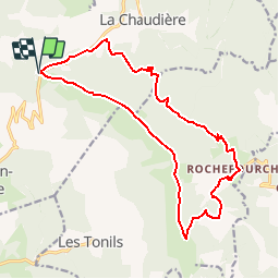

Length
18.1 km

Max alt
1515 m

Uphill gradient
1095 m
Km-Effort
33 km

Min alt
840 m

Downhill gradient
1095 m
Boucle
Yes
Creation date :
2019-04-24 06:52:31.886
Updated on :
2019-04-24 06:52:31.886
--
Difficulty : Unknown

FREE GPS app for hiking
 SityTrail
IGN / Geographical institutes
SityTrail Plus
The world is yours!
About
Trail Other activity of 18.1 km to be discovered at Auvergne-Rhône-Alpes, Drôme, Bézaudun-sur-Bîne. This trail is proposed by collot.
Positioning
Country:
France
Region :
Auvergne-Rhône-Alpes
Department/Province :
Drôme
Municipality :
Bézaudun-sur-Bîne
Location:
Unknown
Start:(Dec)
Start:(UTM)
673195 ; 4943057 (31T) N.
Comments