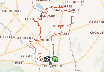
Trail Cycle Conquereuil - Etang de Coisma - Photo
© OpenStreetMap contributors
Length
Length
19.7 km
Max alt
Max alt
53 m
Uphill gradient
Uphill gradient
130 m
Km-Effort
Km-Effort  
21 km
Min alt
Min alt
16 m
Downhill gradient
Downhill gradient
129 m
Boucle
Boucle
Yes
Creation date :
2019-04-02 12:17:03.316
Updated on :
2019-04-02 12:17:03.316

(0 Reviews)

Cycle
Cycle
1h16
Difficulty : Easy

Scan this QR Code to open this trail in the SityTrail application

FREE GPS app for hiking

Logo SityTrail SityTrail

IGN / Geographical institutes

Download SityTrail from the App Store Download SityTrail from Google Play

Logo SityTrail SityTrail Plus

The world is yours!

Download SityTrail from the App Store Download SityTrail from Google Play Download SityTrail on Huawei AppGallery

About

Trail Cycle of 19.7 km to be discovered at Pays de la Loire, Loire-Atlantique, Conquereuil. This trail is proposed by neoroll44.

Description

Le circuit de l'étang de Coisma est plus approprié aux randonneurs à vélo en VTC qu'au pédestre. Ce circuit vous entraîne dans la campagne de Conquereuil, le long de l'étang de Coisma avant d'emprunter une ancienne voie ferrée bien ombragée.

Elevation profile

Positioning

Country:
France
Region :
Pays de la Loire
Department/Province :
Loire-Atlantique
Municipality :
Conquereuil
Location:
Unknown
Start:(UTM)
593815 ; 5275369 (30T) N.


Close
My subscriptions