


Mauritanie jour 3

chrisgps
User
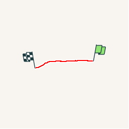

Length
17.5 km

Max alt
721 m

Uphill gradient
387 m
Km-Effort
23 km

Min alt
583 m

Downhill gradient
355 m
Boucle
No
Creation date :
2019-05-08 15:15:58.78
Updated on :
2019-05-08 15:15:58.92
9h41
Difficulty : Medium

FREE GPS app for hiking
 SityTrail
IGN / Geographical institutes
SityTrail Plus
The world is yours!
About
Trail Walking of 17.5 km to be discovered at Adrar. This trail is proposed by chrisgps.
Description
Montagnes de Zarga - Rocher de Drhali-Lemeizin
Positioning
Country:
Mauritania
Region :
Adrar
Department/Province :
Unknown
Municipality :
Unknown
Location:
Unknown
Start:(Dec)
Start:(UTM)
747440 ; 2253492 (28Q) N.
Comments