Trail Walking Conteville-lès-Boulogne - La Fontaine aux Charmes - Conteville-lès-Boulogne - Photo

La Fontaine aux Charmes - Conteville-lès-Boulogne

 tracegps
tracegps

User

© OpenStreetMap contributors
Length
Length
5.8 km
Max alt
Max alt
74 m
Uphill gradient
Uphill gradient
80 m
Km-Effort
Km-Effort  
6.9 km
Min alt
Min alt
26 m
Downhill gradient
Downhill gradient
80 m
Boucle
Boucle
Yes
Creation date :
2014-12-10 00:00:00.0
Updated on :
2014-12-10 00:00:00.0

(1 Reviews)

Walking
Walking
1h30
Difficulty : Easy

Scan this QR Code to open this trail in the SityTrail application

FREE GPS app for hiking

Logo SityTrail SityTrail

IGN / Geographical institutes

Download SityTrail from the App Store Download SityTrail from Google Play

Logo SityTrail SityTrail World

The world is yours!

Download SityTrail from the App Store Download SityTrail from Google Play Download SityTrail on Huawei AppGallery

About

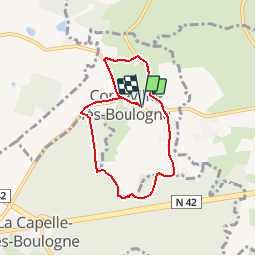
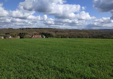
Trail Walking of 5.8 km to be discovered at Hauts-de-France, Pas-de-Calais, Conteville-lès-Boulogne. This trail is proposed by tracegps.

Description

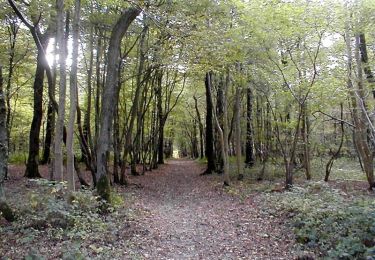
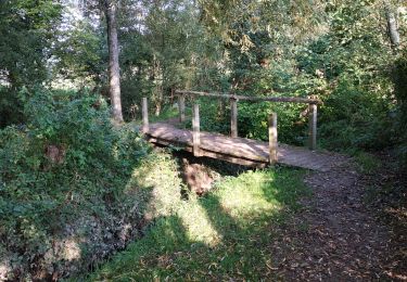
Circuit proposé par le Parc naturel régional des Caps et Marais d’Opale. Départ du parking de la mairie de Conteville-lès-Boulogne En 6 kilomètres seulement, cet itinéraire vous permettra de découvrir à la fois les berges du Wimereux et les ambiances particulières de la forêt domaniales de Boulogne-sur-Mer. Trouverez-vous la fontaine aux Charmes ? Retrouvez le circuit dans le livret 2010 du Parc naturel régional des caps et marais d’Opale.

Elevation profile

Photos

Positioning

Country:
France
Region :
Hauts-de-France
Department/Province :
Pas-de-Calais
Municipality :
Conteville-lès-Boulogne
Location:
Unknown
Start:(UTM)
410627 ; 5622198 (31U) N.

Comments

Please log in to post a review or rate the element


Promenade bien décevante, énormément de routes, départementales entre autres, et la partie dans les bois ne présente que peu d'intérêt, et le ruisseau de la Fontaine aux Charmes est encombré d'arbres coupés anarchiquement, ne permettant même pas d'admirer le ruisseau... à déconseiller


Trails nearby

Trail Walking Baincthun - Sentier de la Pierre de Baincthun - Photo
Walking
tracegps

Walking

Easy
(1)
Baincthun, Hauts-de-France, Pas-de-Calais, France
4 km | 5.2 km-effort
1h 19min
Yes
Trail Walking La Capelle-lès-Boulogne - Sentier des Aulnes - La Capelle-lès-Boulogne - Photo
Walking
tracegps

Walking

Easy
La Capelle-lès-Boulogne, Hauts-de-France, Pas-de-Calais, France
3.3 km | 3.7 km-effort
1h 0min
Yes
Trail Cycle Le Wast - La vallée du Wimereux - Le Wast - Photo
Cycle
tracegps

Cycle

Medium
Le Wast, Hauts-de-France, Pas-de-Calais, France
30 km | 35 km-effort
3h 0min
Yes
Trail On foot Maninghen-Henne - Sentier Le Rendal - Photo
On foot
PRO

On foot

Easy
Maninghen-Henne, Hauts-de-France, Pas-de-Calais, France
4.5 km | 5.4 km-effort
1h 13min
Yes
Trail Walking La Capelle-lès-Boulogne - randonnée Contevilloise - Photo
Walking
Frederic Claptien

Walking

Difficult
La Capelle-lès-Boulogne, Hauts-de-France, Pas-de-Calais, France
10.4 km | 12.3 km-effort
8h 23min
Yes
Trail Walking La Capelle-lès-Boulogne - randonnée Capelloise - Photo
Walking
Frederic Claptien

Walking

Easy
La Capelle-lès-Boulogne, Hauts-de-France, Pas-de-Calais, France
6.2 km | 7 km-effort
2h 26min
Yes
Trail sport Baincthun - Sentier de la Marguerite - Photo
sport
tenace

sport

Very easy
(1)
Baincthun, Hauts-de-France, Pas-de-Calais, France
14 km | 18.2 km-effort
Unknown
Yes
Trail Walking Conteville-lès-Boulogne - La Fontaine aux Charmes - Photo
Walking
philippe.vdv

Walking

Medium
Conteville-lès-Boulogne, Hauts-de-France, Pas-de-Calais, France
6 km | 7.2 km-effort
1h 37min
Yes
Trail Cycle Le Wast - La vallée du Wimereux - Le Wast - Photo
Cycle
Baltykatt

Cycle

Medium
Le Wast, Hauts-de-France, Pas-de-Calais, France
30 km | 34 km-effort
3h 0min
Yes


Close
My subscriptions