Trail Mountain bike Hermelinghen - La Vallée Madame - Hermelinghen - Photo

La Vallée Madame - Hermelinghen

 tracegps
tracegps

User

© OpenStreetMap contributors
Length
Length
19.2 km
Max alt
Max alt
194 m
Uphill gradient
Uphill gradient
217 m
Km-Effort
Km-Effort  
22 km
Min alt
Min alt
87 m
Downhill gradient
Downhill gradient
217 m
Boucle
Boucle
Yes
Creation date :
2014-12-10 00:00:00.0
Updated on :
2014-12-10 00:00:00.0

(0 Reviews)

Mountain bike
Mountain bike
2h30
Difficulty : Medium

Scan this QR Code to open this trail in the SityTrail application

FREE GPS app for hiking

Logo SityTrail SityTrail

IGN / Geographical institutes

Download SityTrail from the App Store Download SityTrail from Google Play

Logo SityTrail SityTrail World

The world is yours!

Download SityTrail from the App Store Download SityTrail from Google Play Download SityTrail on Huawei AppGallery

About

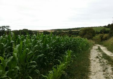
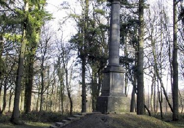
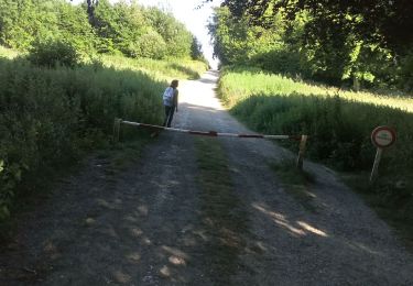
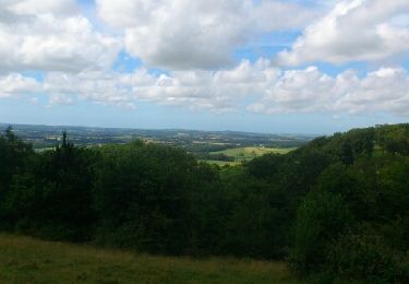
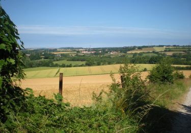
Trail Mountain bike of 19.2 km to be discovered at Hauts-de-France, Pas-de-Calais, Hermelinghen. This trail is proposed by tracegps.

Description

Circuit proposé par le Parc naturel Régional des Caps et Marais d’Opale. Départ de la place de la mairie de Hermelinghem. Les coteaux et les paysages bocagers du pays de Licques s’offrent au regard des amateurs de vélo tout terrain sur un parcours spectaculaire. Retrouvez le circuit dans le livret 2010 du Parc naturel Régional des Caps et Marais d’Opale.

Elevation profile

Photos

Positioning

Country:
France
Region :
Hauts-de-France
Department/Province :
Pas-de-Calais
Municipality :
Hermelinghen
Location:
Unknown
Start:(UTM)
419718 ; 5628443 (31U) N.

Trails nearby

Trail Walking Caffiers - Les Croisettes - Caffiers - Photo
Walking
tracegps

Walking

Medium
(3)
Caffiers, Hauts-de-France, Pas-de-Calais, France
10.7 km | 12.7 km-effort
2h 40min
Yes
Trail Walking Boursin - Sentier du Funquet  - Photo
Walking
Baltykatt

Walking

Easy
(3)
Boursin, Hauts-de-France, Pas-de-Calais, France
10.9 km | 13.3 km-effort
2h 56min
Yes
Trail Walking Licques - Le Cah-Licqu'Co - Licques - Photo
Walking
tracegps

Walking

Difficult
Licques, Hauts-de-France, Pas-de-Calais, France
12.3 km | 15.4 km-effort
3h 4min
Yes
Trail Mountain bike Hermelinghen - Sentier entre les bois  -  Hermelinghen - Photo
Mountain bike
tracegps

Mountain bike

Medium
Hermelinghen, Hauts-de-France, Pas-de-Calais, France
19.3 km | 23 km-effort
2h 0min
Yes
Trail Walking Licques - balade gourmande - Photo
Walking
leon65

Walking

Medium
Licques, Hauts-de-France, Pas-de-Calais, France
48 km | 54 km-effort
7h 22min
No
Trail Walking Alembon - mont ventu  - Photo
Walking
Geliot

Walking

Difficult
Alembon, Hauts-de-France, Pas-de-Calais, France
11.3 km | 14.1 km-effort
3h 3min
Yes
Trail Walking Campagne-lès-Guines - sentier du camp du Drap d'Or - Photo
Walking
tenace

Walking

Easy
Campagne-lès-Guines, Hauts-de-France, Pas-de-Calais, France
13.3 km | 15 km-effort
3h 9min
Yes
Trail Running Bouquehault - rando trail - Photo
Running
Yvan059

Running

Medium
Bouquehault, Hauts-de-France, Pas-de-Calais, France
34 km | 41 km-effort
4h 34min
No
Trail Walking Hardinghen - Le colombier - Hardinghem - Photo
Walking
tracegps

Walking

Medium
(1)
Hardinghen, Hauts-de-France, Pas-de-Calais, France
9.3 km | 10.9 km-effort
2h 0min
Yes


Close
My subscriptions