


Aurielle

Berpav
User
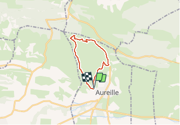

Length
9.2 km

Max alt
261 m

Uphill gradient
231 m
Km-Effort
12.3 km

Min alt
153 m

Downhill gradient
218 m
Boucle
Yes
Creation date :
2019-05-06 22:53:44.758
Updated on :
2021-02-04 14:10:02.907
2h35
Difficulty : Medium

FREE GPS app for hiking
 SityTrail
IGN / Geographical institutes
SityTrail Plus
The world is yours!
About
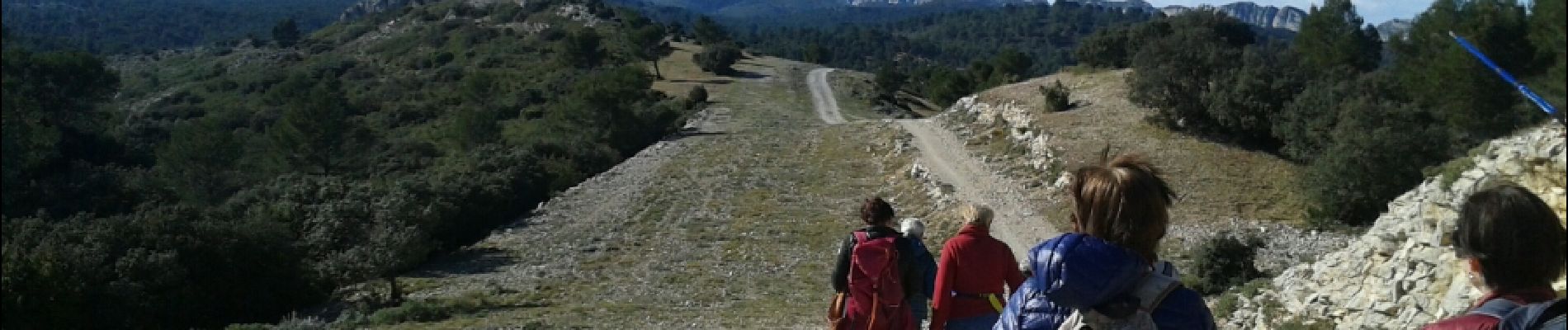
Trail Walking of 9.2 km to be discovered at Provence-Alpes-Côte d'Azur, Bouches-du-Rhône, Aureille. This trail is proposed by Berpav.
Description
marche
Photos


Positioning
Country:
France
Region :
Provence-Alpes-Côte d'Azur
Department/Province :
Bouches-du-Rhône
Municipality :
Aureille
Location:
Unknown
Start:(Dec)
Start:(UTM)
656207 ; 4841391 (31T) N.
Comments