Trail Walking Bâlines - Balade Balinoise - Bâlines - Photo

Balade Balinoise - Bâlines

 tracegps
tracegps

User

© OpenStreetMap contributors
Length
Length
2.9 km
Max alt
Max alt
164 m
Uphill gradient
Uphill gradient
29 m
Km-Effort
Km-Effort  
3.3 km
Min alt
Min alt
148 m
Downhill gradient
Downhill gradient
29 m
Boucle
Boucle
Yes
Creation date :
2014-12-10 00:00:00.0
Updated on :
2014-12-10 00:00:00.0

(0 Reviews)

Walking
Walking
45m
Difficulty : Easy

Scan this QR Code to open this trail in the SityTrail application

FREE GPS app for hiking

Logo SityTrail SityTrail

IGN / Geographical institutes

Download SityTrail from the App Store Download SityTrail from Google Play

Logo SityTrail SityTrail World

The world is yours!

Download SityTrail from the App Store Download SityTrail from Google Play Download SityTrail on Huawei AppGallery

About

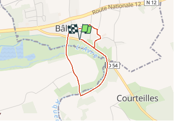
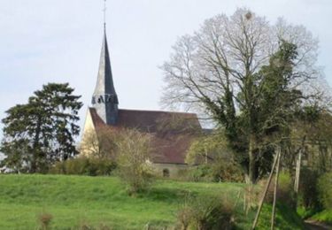
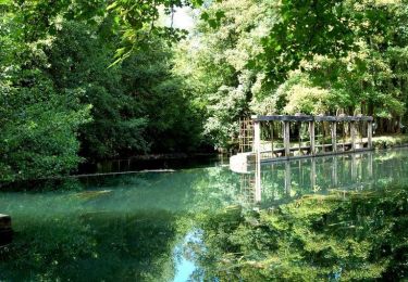
Trail Walking of 2.9 km to be discovered at Normandy, Eure, Bâlines. This trail is proposed by tracegps.

Description

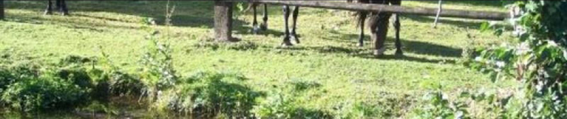
Circuit proposé par l'Office de Tourisme du Pays d'Avre, d'Eure et d'Iton. Une petite balade le long de l'Avre. Idéale en famille, vous croiserez des animaux de la ferme et des chevaux. Départ de la mairie de Bâlines. Retrouvez le circuit et son descriptif sur le site de l'Office de Tourisme du Pays d'Avre, d'Eure et d'Iton.

Elevation profile

Photos

Positioning

Country:
France
Region :
Normandy
Department/Province :
Eure
Municipality :
Bâlines
Location:
Unknown
Start:(UTM)
351432 ; 5400737 (31U) N.

Trails nearby

Trail Walking Verneuil d'Avre et d'Iton - Entre France et Normandie (12 kms) -  Verneuil-sur-Avre - Photo
Walking
tracegps

Walking

Medium
Verneuil d'Avre et d'Iton, Normandy, Eure, France
12 km | 13.3 km-effort
3h 0min
Yes
Trail Walking Verneuil d'Avre et d'Iton - Entre France et Normandie -  Verneuil-sur-Avre - Photo
Walking
tracegps

Walking

Very difficult
(1)
Verneuil d'Avre et d'Iton, Normandy, Eure, France
22 km | 24 km-effort
5h 25min
Yes
Trail Walking Rueil-la-Gadelière - Sur les Pas de Vlaminck -  Rueil-la-Gadelière - Photo
Walking
tracegps

Walking

Medium
Rueil-la-Gadelière, Centre-Loire Valley, Eure-et-Loir, France
8.3 km | 9.2 km-effort
2h 4min
Yes
Trail Walking Courteilles - Circuit des Dames - Courteilles - Photo
Walking
tracegps

Walking

Easy
(1)
Courteilles, Normandy, Eure, France
2.7 km | 3 km-effort
40min
Yes
Trail Walking Montigny-sur-Avre - 2020_05_Montigny sur Avre_Arbres remarquables - Photo
Walking
jeanlucien

Walking

Medium
Montigny-sur-Avre, Centre-Loire Valley, Eure-et-Loir, France
11.3 km | 12.8 km-effort
2h 30min
Yes
Trail On foot Verneuil d'Avre et d'Iton - Verneuil sur Avre 20.28 - Photo
On foot
togolo28

On foot

Medium
Verneuil d'Avre et d'Iton, Normandy, Eure, France
20 km | 22 km-effort
Unknown
Yes
Trail Walking Verneuil d'Avre et d'Iton - VerneuilsurAvre-Montigny - Photo
Walking
douneto

Walking

Medium
Verneuil d'Avre et d'Iton, Normandy, Eure, France
21 km | 24 km-effort
5h 20min
Yes
Trail Mountain bike Tillières-sur-Avre - tour Tillières-Neubourg - Photo
Mountain bike
Christophe.Gilbert

Mountain bike

Medium
Tillières-sur-Avre, Normandy, Eure, France
14.1 km | 15.1 km-effort
1h 51min
Yes
Trail Mountain bike Verneuil d'Avre et d'Iton - Randonnée des sangliers - Photo
Mountain bike
tracegps

Mountain bike

Medium
Verneuil d'Avre et d'Iton, Normandy, Eure, France
57 km | 65 km-effort
3h 0min
Yes


Close
My subscriptions