


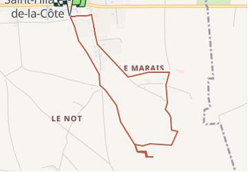
RS-Côteau des épées

raymondfn
User

Length
4.5 km

Max alt
430 m

Uphill gradient
48 m
Km-Effort
5.1 km

Min alt
396 m

Downhill gradient
48 m
Boucle
Yes
Creation date :
2019-05-06 23:13:01.63
Updated on :
2024-02-14 22:35:45.056
1h09
Difficulty : Easy

FREE GPS app for hiking
 SityTrail
IGN / Geographical institutes
SityTrail Plus
The world is yours!
About
Trail Walking of 4.5 km to be discovered at Auvergne-Rhône-Alpes, Isère, Saint-Hilaire-de-la-Côte. This trail is proposed by raymondfn.
Description
Rando Santé
Positioning
Country:
France
Region :
Auvergne-Rhône-Alpes
Department/Province :
Isère
Municipality :
Saint-Hilaire-de-la-Côte
Location:
Unknown
Start:(Dec)
Start:(UTM)
682283 ; 5028862 (31T) N.
Comments
