Trail Walking Mirecourt -  Sentier des luthiers et des dentellières -  Mirecourt - Photo

Sentier des luthiers et des dentellières - Mirecourt

 tracegps
tracegps

User

© OpenStreetMap contributors
Length
Length
15 km
Max alt
Max alt
325 m
Uphill gradient
Uphill gradient
201 m
Km-Effort
Km-Effort  
17.7 km
Min alt
Min alt
260 m
Downhill gradient
Downhill gradient
203 m
Boucle
Boucle
Yes
Creation date :
2014-12-10 00:00:00.0
Updated on :
2014-12-10 00:00:00.0

(0 Reviews)

Walking
Walking
3h45
Difficulty : Difficult

Scan this QR Code to open this trail in the SityTrail application

FREE GPS app for hiking

Logo SityTrail SityTrail

IGN / Geographical institutes

Download SityTrail from the App Store Download SityTrail from Google Play

Logo SityTrail SityTrail World

The world is yours!

Download SityTrail from the App Store Download SityTrail from Google Play Download SityTrail on Huawei AppGallery

About

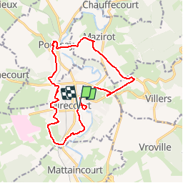
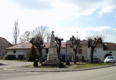
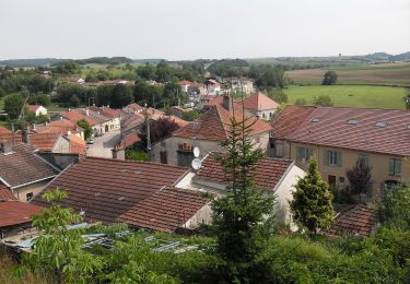
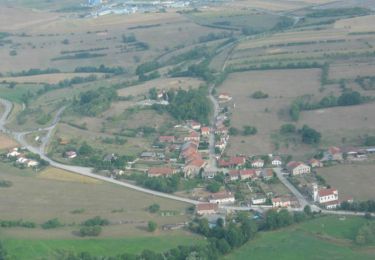
Trail Walking of 15 km to be discovered at Grand Est, Vosges, Mirecourt. This trail is proposed by tracegps.

Description

Circuit proposé par la communauté de communes de Mirecourt. Départ de la place Thierry à Mirecourt.

Elevation profile

Photos

Positioning

Country:
France
Region :
Grand Est
Department/Province :
Vosges
Municipality :
Mirecourt
Location:
Unknown
Start:(UTM)
287590 ; 5353560 (32U) N.

Trails nearby

Trail On foot Mirecourt - Sentier des Écoliers - Photo
On foot
PRO

On foot

Easy
Mirecourt, Grand Est, Vosges, France
7.3 km | 9.1 km-effort
2h 4min
Yes
Trail On foot Mazirot - Sentier des Trois Fontaines - Photo
On foot
PRO

On foot

Easy
Mazirot, Grand Est, Vosges, France
10.7 km | 13.1 km-effort
2h 59min
Yes
Trail On foot Domvallier - Sentier Victor Hugo - Photo
On foot
PRO

On foot

Easy
Domvallier, Grand Est, Vosges, France
13.8 km | 17.1 km-effort
3h 52min
Yes
Trail On foot Mirecourt - Sentier des Luthiers et des Dentellières - Photo
On foot
PRO

On foot

Easy
Mirecourt, Grand Est, Vosges, France
14.6 km | 17.1 km-effort
3h 53min
Yes
Trail On foot Puzieux - Sentier Sainte-Menne - Photo
On foot
PRO

On foot

Easy
Puzieux, Grand Est, Vosges, France
12.4 km | 14.1 km-effort
3h 12min
Yes
Trail On foot Villers - GR 507 (variante) - Photo
On foot
PRO

On foot

Easy
Villers, Grand Est, Vosges, France
5.6 km | 7.1 km-effort
1h 36min
No
Trail On foot Mattaincourt - Sentier du bois de Malaumont - Photo
On foot
PRO

On foot

Easy
Mattaincourt, Grand Est, Vosges, France
3.5 km | 4.5 km-effort
1h 1min
Yes
Trail Walking Domvallier - Sentier Victor Hugo avec variantes  - Domvallier - Photo
Walking
tracegps

Walking

Medium
Domvallier, Grand Est, Vosges, France
10.8 km | 13.8 km-effort
2h 40min
Yes
Trail Walking Ramecourt - Sentier Ste-Menne - Ramecourt - Photo
Walking
tracegps

Walking

Medium
Ramecourt, Grand Est, Vosges, France
10.6 km | 12.1 km-effort
2h 40min
Yes


Close
My subscriptions