


balade à Mayenne

Axelloceane
User
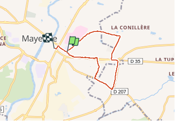

Length
6.1 km

Max alt
139 m

Uphill gradient
39 m
Km-Effort
6.6 km

Min alt
110 m

Downhill gradient
46 m
Boucle
No
Creation date :
2018-02-07 00:00:00.0
Updated on :
2018-02-07 00:00:00.0
1h28
Difficulty : Easy

FREE GPS app for hiking
 SityTrail
IGN / Geographical institutes
SityTrail Plus
The world is yours!
About
Trail Walking of 6.1 km to be discovered at Pays de la Loire, Mayenne, Mayenne. This trail is proposed by Axelloceane.
Positioning
Country:
France
Region :
Pays de la Loire
Department/Province :
Mayenne
Municipality :
Mayenne
Location:
Unknown
Start:(Dec)
Start:(UTM)
677382 ; 5352541 (30U) N.
Comments