


Le Bau de Saint-Jean via le Pey Subert

Renefrt
User
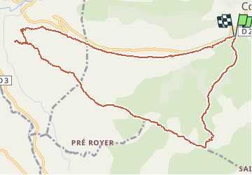

Length
12.6 km

Max alt
1142 m

Uphill gradient
498 m
Km-Effort
19.3 km

Min alt
775 m

Downhill gradient
498 m
Boucle
Yes
Creation date :
2019-04-24 11:19:31.153
Updated on :
2019-04-24 11:19:31.153
--
Difficulty : Unknown

FREE GPS app for hiking
 SityTrail
IGN / Geographical institutes
SityTrail Plus
The world is yours!
About
Trail Other activity of 12.6 km to be discovered at Provence-Alpes-Côte d'Azur, Maritime Alps, Coursegoules. This trail is proposed by Renefrt.


Positioning
Country:
France
Region :
Provence-Alpes-Côte d'Azur
Department/Province :
Maritime Alps
Municipality :
Coursegoules
Location:
Unknown
Start:(Dec)
Start:(UTM)
341843 ; 4850259 (32T) N.
Comments