


vtt argelliers

xav34830
User
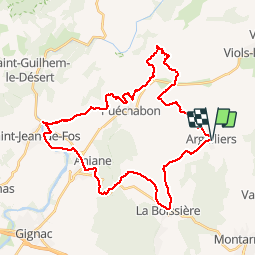

Length
40 km

Max alt
481 m

Uphill gradient
725 m
Km-Effort
50 km

Min alt
49 m

Downhill gradient
726 m
Boucle
Yes
Creation date :
2019-05-07 01:48:57.559
Updated on :
2019-05-07 01:48:57.559
3h29
Difficulty : Medium

FREE GPS app for hiking
 SityTrail
IGN / Geographical institutes
SityTrail Plus
The world is yours!
About
Trail Mountain bike of 40 km to be discovered at Occitania, Hérault, Argelliers. This trail is proposed by xav34830.
Positioning
Country:
France
Region :
Occitania
Department/Province :
Hérault
Municipality :
Argelliers
Location:
Unknown
Start:(Dec)
Start:(UTM)
554325 ; 4838641 (31T) N.
Comments