


St zacharie Nayes

Nathy8913
User

Length
17 km

Max alt
837 m

Uphill gradient
715 m
Km-Effort
27 km

Min alt
276 m

Downhill gradient
725 m
Boucle
Yes
Creation date :
2019-05-07 01:48:58.057
Updated on :
2019-05-07 01:48:58.057
6h14
Difficulty : Unknown

FREE GPS app for hiking
 SityTrail
IGN / Geographical institutes
SityTrail Plus
The world is yours!
About
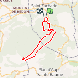
Trail Walking of 17 km to be discovered at Provence-Alpes-Côte d'Azur, Var, Saint-Zacharie. This trail is proposed by Nathy8913.
Description
difficile
Positioning
Country:
France
Region :
Provence-Alpes-Côte d'Azur
Department/Province :
Var
Municipality :
Saint-Zacharie
Location:
Unknown
Start:(Dec)
Start:(UTM)
719535 ; 4805899 (31T) N.
Comments