


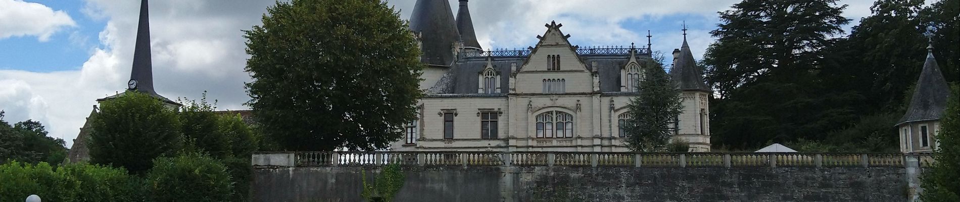
Véretz - Nitray - AR - 2015 11 08

Orcal37
User GUIDE
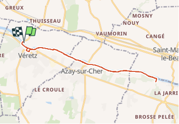

Length
16.4 km

Max alt
74 m

Uphill gradient
122 m
Km-Effort
18 km

Min alt
45 m

Downhill gradient
122 m
Boucle
Yes
Creation date :
2019-05-07 01:56:21.65
Updated on :
2021-08-01 18:02:02.935
3h25
Difficulty : Easy

FREE GPS app for hiking
 SityTrail
IGN / Geographical institutes
SityTrail Plus
The world is yours!
About
Trail Walking of 16.4 km to be discovered at Centre-Loire Valley, Indre-et-Loire, Véretz. This trail is proposed by Orcal37.
Description
Véretz - Nitray - GR AR - 2015 11 08
Photos


Positioning
Country:
France
Region :
Centre-Loire Valley
Department/Province :
Indre-et-Loire
Municipality :
Véretz
Location:
Unknown
Start:(Dec)
Start:(UTM)
334346 ; 5247667 (31T) N.
Comments