


La-Chapelle-St-Blaise (Azay) - GR3 nord - 18.3km 180m 3h55 - 2018 04 15

Orcal37
User GUIDE
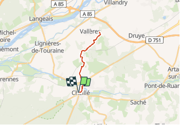

Length
18.3 km

Max alt
99 m

Uphill gradient
205 m
Km-Effort
21 km

Min alt
41 m

Downhill gradient
205 m
Boucle
Yes
Creation date :
2019-05-07 01:57:15.973
Updated on :
2020-09-04 15:28:06.452
3h55
Difficulty : Medium

FREE GPS app for hiking
 SityTrail
IGN / Geographical institutes
SityTrail Plus
The world is yours!
About
Trail Walking of 18.3 km to be discovered at Centre-Loire Valley, Indre-et-Loire, Cheillé. This trail is proposed by Orcal37.
Description
La-Chapelle-St-Blaise Azay-le-Rideau la Vallée du Vau - GR3 nord - 18.3km 180m 3h55 - 2018 04 15
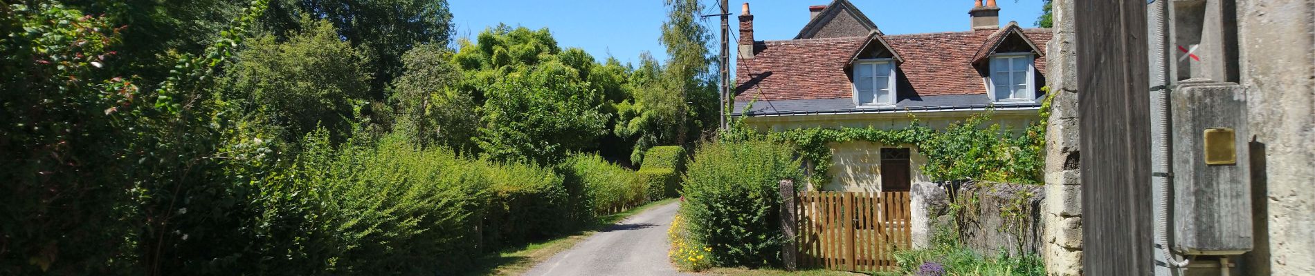
Photos
 - GR3 nord - 18.3km 180m 3h55 - 2018 04 15 - Photo 1")
Positioning
Country:
France
Region :
Centre-Loire Valley
Department/Province :
Indre-et-Loire
Municipality :
Cheillé
Location:
Unknown
Start:(Dec)
Start:(UTM)
307742 ; 5236583 (31T) N.
Comments