


Lavardin - 3.9km 1h00 - 2018 01 14

Orcal37
User GUIDE
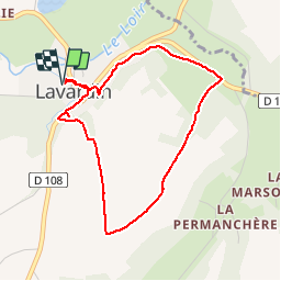

Length
3.9 km

Max alt
136 m

Uphill gradient
78 m
Km-Effort
4.9 km

Min alt
69 m

Downhill gradient
77 m
Boucle
Yes
Creation date :
2019-05-07 01:57:22.491
Updated on :
2019-08-11 15:38:17.657
1h00
Difficulty : Very easy

FREE GPS app for hiking
 SityTrail
IGN / Geographical institutes
SityTrail Plus
The world is yours!
About
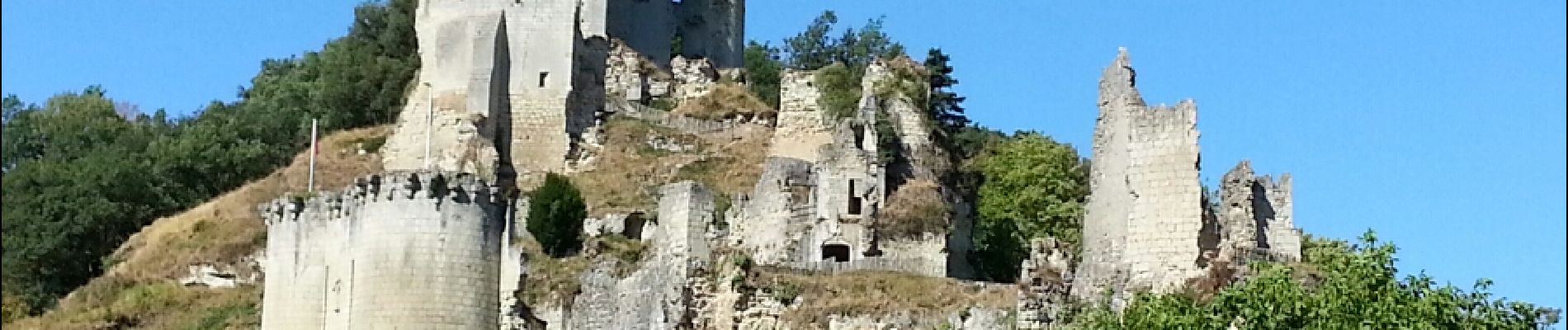
Trail Walking of 3.9 km to be discovered at Centre-Loire Valley, Loir-et-Cher. This trail is proposed by Orcal37.
Description
Lavardin - 3.9km 1h00 - 2018 01 14
Photos

Positioning
Country:
France
Region :
Centre-Loire Valley
Department/Province :
Loir-et-Cher
Municipality :
LAVARDIN
Location:
Unknown
Start:(Dec)
Start:(UTM)
341396 ; 5289800 (31T) N.
Comments