Trail Walking Huisnes-sur-Mer - Mont-St-Michel - 14km 64m 4h30 - 2017 06 26 - Photo

Mont-St-Michel - 14km 64m 4h30 - 2017 06 26

 Orcal37
Orcal37

User

© OpenStreetMap contributors
Length
Length
14 km
Max alt
Max alt
30 m
Uphill gradient
Uphill gradient
75 m
Km-Effort
Km-Effort  
15 km
Min alt
Min alt
0 m
Downhill gradient
Downhill gradient
74 m
Boucle
Boucle
Yes
Creation date :
2019-05-07 01:57:24.983
Updated on :
2019-08-14 18:34:37.159

(0 Reviews)

Walking
Walking
4h30
Difficulty : Easy

Scan this QR Code to open this trail in the SityTrail application

FREE GPS app for hiking

Logo SityTrail SityTrail

IGN / Geographical institutes

Download SityTrail from the App Store Download SityTrail from Google Play

Logo SityTrail SityTrail World

The world is yours!

Download SityTrail from the App Store Download SityTrail from Google Play Download SityTrail on Huawei AppGallery

About

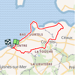
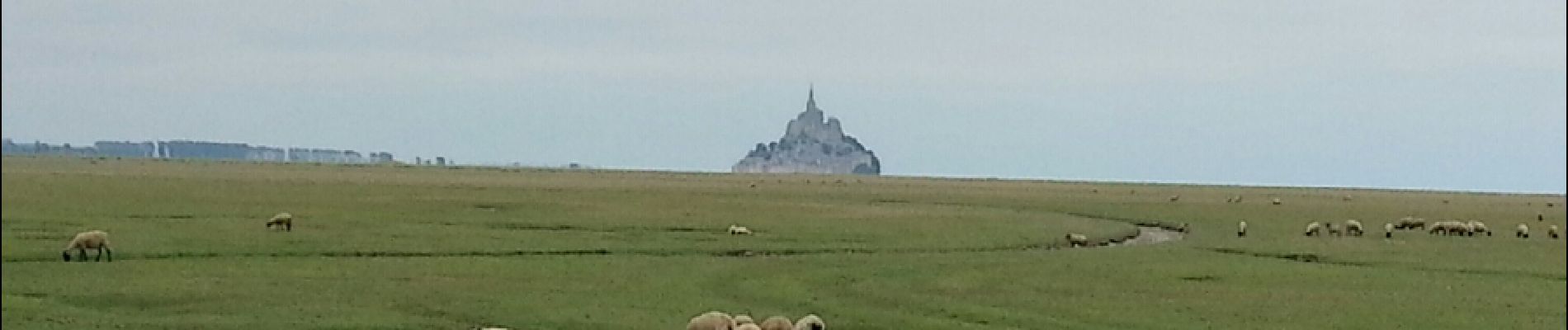
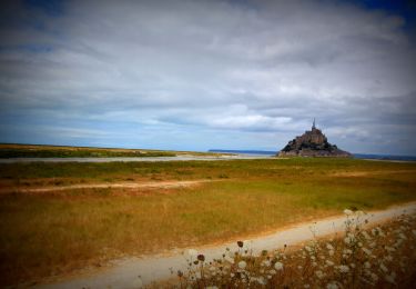
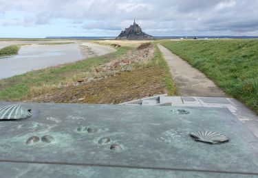
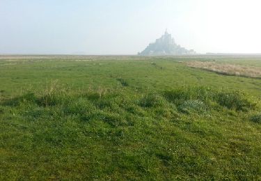
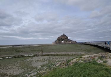
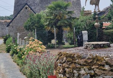
Trail Walking of 14 km to be discovered at Normandy, Manche, Huisnes-sur-Mer. This trail is proposed by Orcal37.

Description

Mont-St-Michel - Pointe de Roche Torin - 14km 64m 4h30 45mn dej - 2017 06 26

Elevation profile

Photos

27 photos in total. Please click on a photo to see them all in the gallery.

Positioning

Country:
France
Region :
Normandy
Department/Province :
Manche
Municipality :
Huisnes-sur-Mer
Location:
Unknown
Start:(UTM)
614099 ; 5386675 (30U) N.

Trails nearby

Trail Mountain bike Beauvoir - SityTrail - 2506836 - beauvoir_20200724_092923 - Photo
Mountain bike
GUIDE
pascalou73

Mountain bike

Medium
Beauvoir, Normandy, Manche, France
29 km | 32 km-effort
Unknown
Yes
Trail Walking Courtils - La roche taurin Mont st michel - Photo
Walking
mamyzine

Walking

Easy
(1)
Courtils, Normandy, Manche, France
10.8 km | 11.4 km-effort
3h 52min
No
Trail Walking Le Mont-Saint-Michel - GR_34_AA_01_Mt-St-Michel_St-Marcan_20230318 - Photo
Walking
patrickdanilo

Walking

Very easy
Le Mont-Saint-Michel, Normandy, Manche, France
16.7 km | 18.7 km-effort
4h 1min
No
Trail Walking Le Mont-Saint-Michel - Mont St Michel J2 - Photo
Walking
chessyca

Walking

Very easy
Le Mont-Saint-Michel, Normandy, Manche, France
17.4 km | 21 km-effort
4h 22min
Yes
Trail Walking Le Mont-Saint-Michel - Mont St Michel J1 - Photo
Walking
chessyca

Walking

Difficult
Le Mont-Saint-Michel, Normandy, Manche, France
12.1 km | 14 km-effort
2h 46min
Yes
Trail Walking Beauvoir - GR_37_AA_15_Beauvoir_Pleine-Fougeres_20210521 - Photo
Walking
patrickdanilo

Walking

Very easy
Beauvoir, Normandy, Manche, France
14.2 km | 15.5 km-effort
3h 8min
No
Trail Walking Pontorson - GR34 étape 6 - Photo
Walking
lagardienne

Walking

Easy
Pontorson, Normandy, Manche, France
23 km | 25 km-effort
5h 30min
No
Trail Walking Pontorson - 2020-03-19 mont saint Michel  - Photo
Walking
jacq58

Walking

Medium
Pontorson, Normandy, Manche, France
6.5 km | 7.5 km-effort
1h 2min
No
Trail Walking Pontorson - RA 2023 Les Polders - Photo
Walking
dfluzin

Walking

Very difficult
Pontorson, Normandy, Manche, France
18.1 km | 21 km-effort
5h 25min
No


Close
My subscriptions