


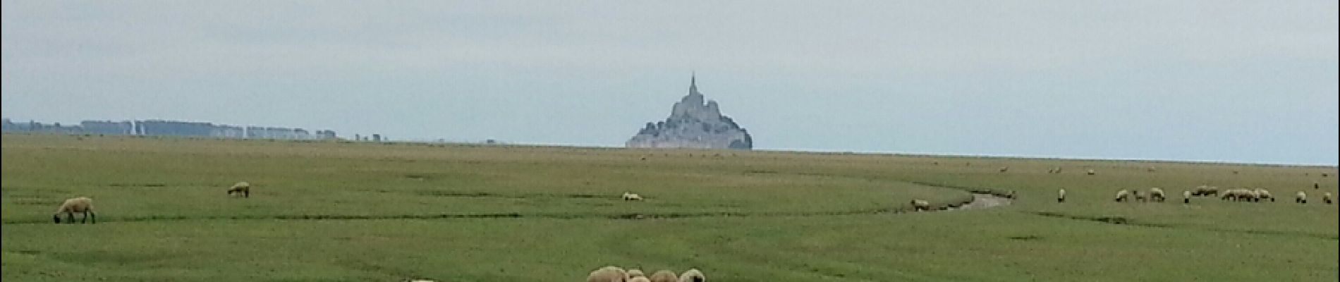
Mont-St-Michel - 14km 64m 4h30 - 2017 06 26

Orcal37
User GUIDE
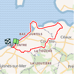

Length
14 km

Max alt
30 m

Uphill gradient
75 m
Km-Effort
15 km

Min alt
0 m

Downhill gradient
74 m
Boucle
Yes
Creation date :
2019-05-07 01:57:24.983
Updated on :
2019-08-14 18:34:37.159
4h30
Difficulty : Easy

FREE GPS app for hiking
 SityTrail
IGN / Geographical institutes
SityTrail Plus
The world is yours!
About
Trail Walking of 14 km to be discovered at Normandy, Manche, Huisnes-sur-Mer. This trail is proposed by Orcal37.
Description
Mont-St-Michel - Pointe de Roche Torin - 14km 64m 4h30 45mn dej - 2017 06 26
Photos


27 photos in total. Please click on a photo to see them all in the gallery.
Positioning
Country:
France
Region :
Normandy
Department/Province :
Manche
Municipality :
Huisnes-sur-Mer
Location:
Unknown
Start:(Dec)
Start:(UTM)
614099 ; 5386675 (30U) N.
Comments