


Saint-Malo - 7.7km 110m 3h00 - 2017 06 18

Orcal37
User GUIDE
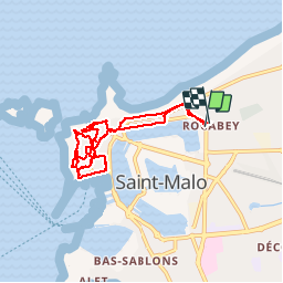

Length
7.7 km

Max alt
28 m

Uphill gradient
91 m
Km-Effort
8.9 km

Min alt
2 m

Downhill gradient
91 m
Boucle
Yes
Creation date :
2019-05-07 01:57:29.682
Updated on :
2019-08-14 17:42:26.835
3h00
Difficulty : Very easy

FREE GPS app for hiking
 SityTrail
IGN / Geographical institutes
SityTrail Plus
The world is yours!
About
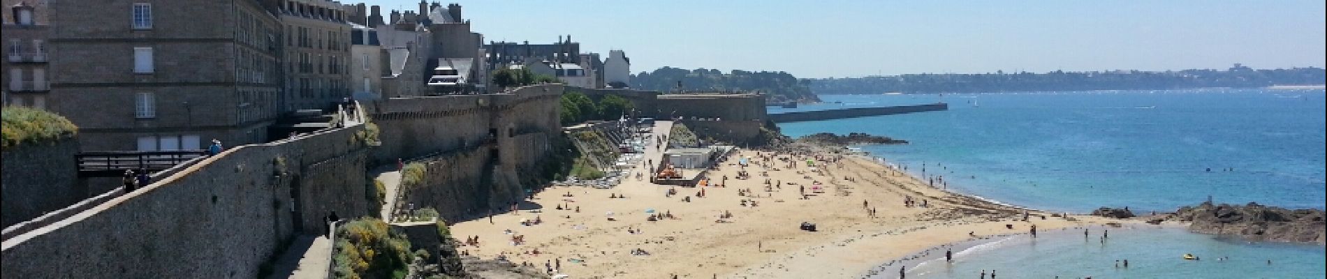
Trail Walking of 7.7 km to be discovered at Brittany, Ille-et-Vilaine, Saint-Malo. This trail is proposed by Orcal37.
Description
Saint-Malo - 7.7km 110m 3h00 - 2017 06 18
Photos


Positioning
Country:
France
Region :
Brittany
Department/Province :
Ille-et-Vilaine
Municipality :
Saint-Malo
Location:
Unknown
Start:(Dec)
Start:(UTM)
573018 ; 5389156 (30U) N.
Comments