


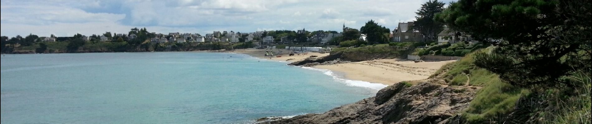
Lancieux - 8.5km 100m 2h40 - 2017 06 29

Orcal37
User GUIDE
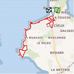

Length
9.5 km

Max alt
29 m

Uphill gradient
85 m
Km-Effort
10.7 km

Min alt
0 m

Downhill gradient
84 m
Boucle
Yes
Creation date :
2019-05-07 01:57:31.294
Updated on :
2019-08-14 18:15:06.8
2h40
Difficulty : Very easy

FREE GPS app for hiking
 SityTrail
IGN / Geographical institutes
SityTrail Plus
The world is yours!
About
Trail Walking of 9.5 km to be discovered at Brittany, Côtes-d'Armor, Lancieux. This trail is proposed by Orcal37.
Description
Lancieux - 8.5km 100m 2h40 40mn pause - 2017 06 29
Photos


Positioning
Country:
France
Region :
Brittany
Department/Province :
Côtes-d'Armor
Municipality :
Lancieux
Location:
Unknown
Start:(Dec)
Start:(UTM)
562635 ; 5384385 (30U) N.
Comments