


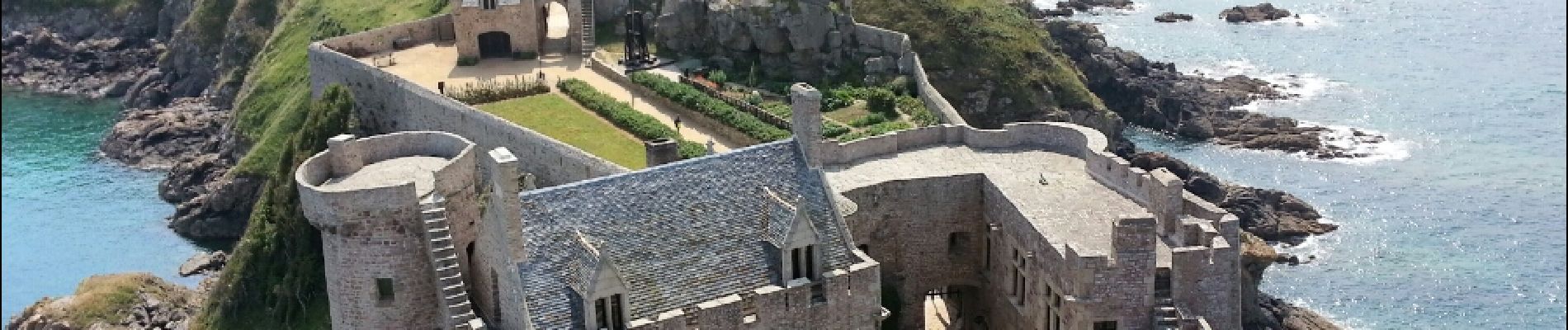
Fort La Latte - 2017 06 22

Orcal37
User GUIDE
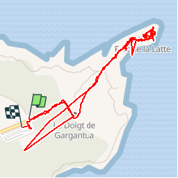

Length
3.1 km

Max alt
64 m

Uphill gradient
67 m
Km-Effort
4 km

Min alt
5 m

Downhill gradient
67 m
Boucle
Yes
Creation date :
2019-05-07 01:57:32.443
Updated on :
2019-08-14 18:11:15.352
1h00
Difficulty : Very easy

FREE GPS app for hiking
 SityTrail
IGN / Geographical institutes
SityTrail Plus
The world is yours!
About
Trail Walking of 3.1 km to be discovered at Brittany, Côtes-d'Armor, Plévenon. This trail is proposed by Orcal37.
Description
Fort La Latte - 2017 06 22
Photos


Positioning
Country:
France
Region :
Brittany
Department/Province :
Côtes-d'Armor
Municipality :
Plévenon
Location:
Unknown
Start:(Dec)
Start:(UTM)
552142 ; 5390466 (30U) N.
Comments