


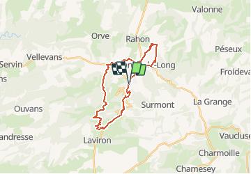
depart sancey le grand

gerardmicheline
User

Length
23 km

Max alt
860 m

Uphill gradient
685 m
Km-Effort
32 km

Min alt
468 m

Downhill gradient
688 m
Boucle
Yes
Creation date :
2019-05-07 02:30:44.132
Updated on :
2021-01-10 15:05:38.902
5h09
Difficulty : Unknown

FREE GPS app for hiking
 SityTrail
IGN / Geographical institutes
SityTrail Plus
The world is yours!
About
Trail Other activity of 23 km to be discovered at Bourgogne-Franche-Comté, Doubs, Sancey. This trail is proposed by gerardmicheline.
Positioning
Country:
France
Region :
Bourgogne-Franche-Comté
Department/Province :
Doubs
Municipality :
Sancey
Location:
Unknown
Start:(Dec)
Start:(UTM)
317189 ; 5240575 (32T) N.
Comments