


vallée de chaudefour

choubaka77
User
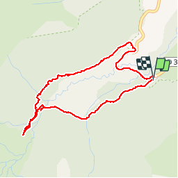

Length
4.3 km

Max alt
1239 m

Uphill gradient
116 m
Km-Effort
5.9 km

Min alt
1131 m

Downhill gradient
125 m
Boucle
Yes
Creation date :
2019-05-07 03:04:26.017
Updated on :
2019-05-07 03:04:26.017
1h53
Difficulty : Very easy

FREE GPS app for hiking
 SityTrail
IGN / Geographical institutes
SityTrail Plus
The world is yours!
About
Trail Walking of 4.3 km to be discovered at Auvergne-Rhône-Alpes, Puy-de-Dôme, Chambon-sur-Lac. This trail is proposed by choubaka77.
Description
Une petite sortie pour découvrir le cirque de chudefour
Photos


Positioning
Country:
France
Region :
Auvergne-Rhône-Alpes
Department/Province :
Puy-de-Dôme
Municipality :
Chambon-sur-Lac
Location:
Unknown
Start:(Dec)
Start:(UTM)
489158 ; 5042967 (31T) N.
Comments