


la nuit - étape 2 + retour :-(

i20
User
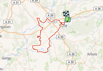

Length
132 km

Max alt
308 m

Uphill gradient
875 m
Km-Effort
144 km

Min alt
174 m

Downhill gradient
869 m
Boucle
No
Creation date :
2014-12-10 00:00:00.0
Updated on :
2014-12-10 00:00:00.0
3h43
Difficulty : Very difficult

FREE GPS app for hiking
 SityTrail
IGN / Geographical institutes
SityTrail Plus
The world is yours!
About
Trail Other activity of 132 km to be discovered at Bourgogne-Franche-Comté, Jura, Dole. This trail is proposed by i20.
Positioning
Country:
France
Region :
Bourgogne-Franche-Comté
Department/Province :
Jura
Municipality :
Dole
Location:
Unknown
Start:(Dec)
Start:(UTM)
689782 ; 5218461 (31T) N.
Comments