Trail Walking Gagny - Rando 26 km - Dhuis - Photo
© OpenStreetMap contributors
Length
Length
26 km
Max alt
Max alt
134 m
Uphill gradient
Uphill gradient
280 m
Km-Effort
Km-Effort  
30 km
Min alt
Min alt
45 m
Downhill gradient
Downhill gradient
291 m
Boucle
Boucle
No
Creation date :
2014-12-10 00:00:00.0
Updated on :
2014-12-10 00:00:00.0

(1 Reviews)

Walking
Walking
--
Difficulty : Easy

Scan this QR Code to open this trail in the SityTrail application

FREE GPS app for hiking

Logo SityTrail SityTrail

IGN / Geographical institutes

Download SityTrail from the App Store Download SityTrail from Google Play

Logo SityTrail SityTrail World

The world is yours!

Download SityTrail from the App Store Download SityTrail from Google Play Download SityTrail on Huawei AppGallery

About

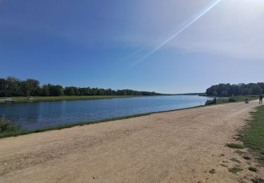
Trail Walking of 26 km to be discovered at Ile-de-France, Seine-Saint-Denis, Gagny. This trail is proposed by benoit92320.

Elevation profile

Points of interest

Positioning

Country:
France
Region :
Ile-de-France
Department/Province :
Seine-Saint-Denis
Municipality :
Gagny
Location:
Unknown
Start:(UTM)
467210 ; 5413881 (31U) N.

Comments

Please log in to post a review or rate the element


trop de disparitions de cartes pendant la randonnée. je ne arrive pas à télécharger complètement les cartes


Trails nearby

Trail Walking Neuilly-Plaisance - Neuilly Plaisance gare Rer sortie Bords de Marne/ Base Nautique Vaires sur Marne - Photo
Walking
thierry cachot

Walking

Easy
(1)
Neuilly-Plaisance, Ile-de-France, Seine-Saint-Denis, France
15.9 km | 17.1 km-effort
2h 52min
Yes
Trail Walking Chelles - GRP CV-IDF 06 - Photo
Walking
clalaur

Walking

Medium
(1)
Chelles, Ile-de-France, Seine-et-Marne, France
15 km | 16.7 km-effort
3h 47min
No
Trail Walking Noisiel - Noisiel Grand parcours - Photo
Walking
CC.RIDER

Walking

Easy
(1)
Noisiel, Ile-de-France, Seine-et-Marne, France
21 km | 23 km-effort
4h 50min
Yes
Trail Mountain bike Fontenay-sous-Bois - vtt bois de vincennes - Photo
Mountain bike
jknc988

Mountain bike

Medium
(1)
Fontenay-sous-Bois, Ile-de-France, Val-de-Marne, France
38 km | 42 km-effort
1h 59min
Yes
Trail Walking Montfermeil - GRP CV-IDF 11R Montfermeil à Chelles - Photo
Walking
clalaur

Walking

Medium
Montfermeil, Ile-de-France, Seine-Saint-Denis, France
10.3 km | 11.9 km-effort
2h 42min
No
Trail On foot Gournay-sur-Marne - PR des Bords de Marne - Photo
On foot
PRO

On foot

Easy
Gournay-sur-Marne, Ile-de-France, Seine-Saint-Denis, France
7.3 km | 8 km-effort
1h 48min
No
Trail Walking Gournay-sur-Marne - Boucle Gournay/ Marne - Noisy le Grand - Champs sur Marne - Photo
Walking
chessyca

Walking

Very easy
Gournay-sur-Marne, Ile-de-France, Seine-Saint-Denis, France
20 km | 23 km-effort
4h 41min
Yes
Trail Walking Neuilly-Plaisance - NEUILLY PLAISANCE 9 KM - Photo
Walking
gemau77

Walking

Medium
(1)
Neuilly-Plaisance, Ile-de-France, Seine-Saint-Denis, France
9.8 km | 10.8 km-effort
2h 27min
No
Trail Walking Chelles - Chelles_Montfermeil_Chelles-11039915-1628508469-77 - Photo
Walking
gemau77

Walking

Very difficult
(1)
Chelles, Ile-de-France, Seine-et-Marne, France
17.5 km | 21 km-effort
4h 44min
Yes


Close
My subscriptions