Trail Walking Luynes - Luynes Buissonnière - Photo
 Patakk
Patakk

User

© OpenStreetMap contributors
Length
Length
18.7 km
Max alt
Max alt
108 m
Uphill gradient
Uphill gradient
218 m
Km-Effort
Km-Effort  
22 km
Min alt
Min alt
40 m
Downhill gradient
Downhill gradient
218 m
Boucle
Boucle
Yes
Creation date :
2014-12-10 00:00:00.0
Updated on :
2014-12-10 00:00:00.0

(2 Reviews)

Walking
Walking
4h00
Difficulty : Medium

Scan this QR Code to open this trail in the SityTrail application

FREE GPS app for hiking

Logo SityTrail SityTrail

IGN / Geographical institutes

Download SityTrail from the App Store Download SityTrail from Google Play

Logo SityTrail SityTrail World

The world is yours!

Download SityTrail from the App Store Download SityTrail from Google Play Download SityTrail on Huawei AppGallery

About

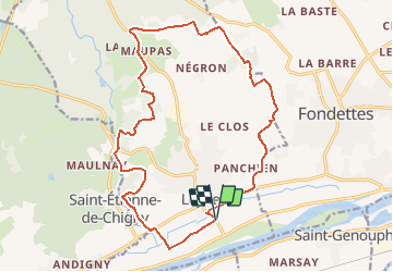
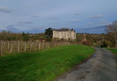
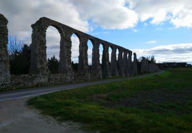
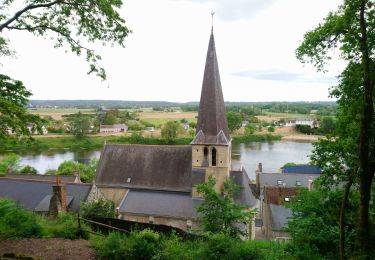
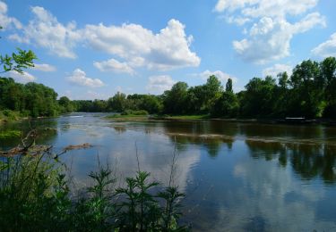
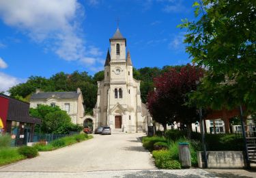
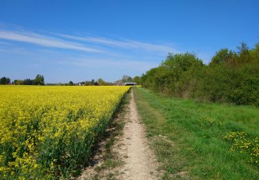
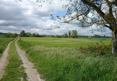
Trail Walking of 18.7 km to be discovered at Centre-Loire Valley, Indre-et-Loire, Luynes. This trail is proposed by Patakk.

Description

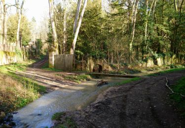
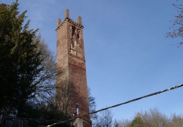
Randonnée agréable et variée : prairies humides, forêts de feuillus, cultures céréalières coupées de haies...

Elevation profile

Points of interest

Point of interest Luynes - Aqueduc - Photo
Patakk
LUYNES 

Positioning

Country:
France
Region :
Centre-Loire Valley
Department/Province :
Indre-et-Loire
Municipality :
Luynes
Location:
Unknown
Start:(UTM)
315719 ; 5250359 (31T) N.

Comments

Please log in to post a review or rate the element


c est bon je l ai deja evalué...pfff


Trails nearby

Trail Walking Ballan-Miré - Ballan-Miré - Parking des Châtaigniers - 8.4km 125m 1h50 - 2024 03 06 - Photo
Walking
Orcal37

Walking

Medium
Ballan-Miré, Centre-Loire Valley, Indre-et-Loire, France
8.4 km | 10.1 km-effort
1h 50min
Yes
Trail Walking Saint-Étienne-de-Chigny - Saint-Étienne-de-Chigny - le Vieux Bourg - Luynes - 15.8km 285m 3h30 - 2024 02 28 - Photo
Walking
Orcal37

Walking

Medium
Saint-Étienne-de-Chigny, Centre-Loire Valley, Indre-et-Loire, France
15.8 km | 19.6 km-effort
3h 30min
Yes
Trail Walking Saint-Étienne-de-Chigny - Saint-Étienne-de-Chigny - la Pile de Cinq-Mars-la-Pile - 14.2km 215m 3h15 - 2024 02 17 - Photo
Walking
Orcal37

Walking

Medium
Saint-Étienne-de-Chigny, Centre-Loire Valley, Indre-et-Loire, France
14.5 km | 17.2 km-effort
3h 15min
Yes
Trail Walking Luynes - Luynes - Aqueduc gallo-romain - 12.6km 115m 2h50 - 2023 02 19 - Photo
Walking
Orcal37

Walking

Easy
Luynes, Centre-Loire Valley, Indre-et-Loire, France
12.6 km | 14.2 km-effort
2h 50min
Yes
Trail Walking Savonnières - Savonnières - les Fontaines GR3 et PRs - 20.1km 190m 4h40 - 2022 05 12 - Photo
Walking
Orcal37

Walking

Easy
Savonnières, Centre-Loire Valley, Indre-et-Loire, France
20 km | 23 km-effort
4h 40min
Yes
Trail Walking Berthenay - Berthenay - Sentier des deux Eaux - 16.3km 65m 4h00 - 2022 05 08 - Photo
Walking
Orcal37

Walking

Easy
Berthenay, Centre-Loire Valley, Indre-et-Loire, France
16.3 km | 17.2 km-effort
4h 0min
Yes
Trail Walking Saint-Étienne-de-Chigny - Saint-Étienne-de-Chigny - Pont de Bresme - 23.4km 275m 4h45 (25mn) - 2021 07 08 - Photo
Walking
Orcal37

Walking

Easy
Saint-Étienne-de-Chigny, Centre-Loire Valley, Indre-et-Loire, France
23 km | 27 km-effort
4h 45min
Yes
Trail Walking Fondettes - Fondettes - Impro 4 communes - 21.6km 200m 4h40 (30mn) - 2021 04 24 - Photo
Walking
Orcal37

Walking

Easy
Fondettes, Centre-Loire Valley, Indre-et-Loire, France
22 km | 24 km-effort
4h 40min
Yes
Trail Walking Fondettes - Fondettes - Sentier Aubrière-Gâtine - 9.6km 110m 2h00 - 2019 05 05 - Photo
Walking
Orcal37

Walking

Very easy
Fondettes, Centre-Loire Valley, Indre-et-Loire, France
9.6 km | 11.1 km-effort
2h 0min
Yes


Close
My subscriptions