


Oud-Turnhout 2012/03

raydela
User
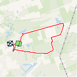

Length
6.8 km

Max alt
39 m

Uphill gradient
46 m
Km-Effort
7.4 km

Min alt
21 m

Downhill gradient
46 m
Boucle
Yes
Creation date :
2014-12-10 00:00:00.0
Updated on :
2014-12-10 00:00:00.0
1h38
Difficulty : Easy

FREE GPS app for hiking
 SityTrail
IGN / Geographical institutes
SityTrail Plus
The world is yours!
About
Trail Walking of 6.8 km to be discovered at Flanders, Antwerp, Oud-Turnhout. This trail is proposed by raydela.
Positioning
Country:
Belgium
Region :
Flanders
Department/Province :
Antwerp
Municipality :
Oud-Turnhout
Location:
Oud-Turnhout
Start:(Dec)
Start:(UTM)
639620 ; 5688165 (31U) N.
Comments