


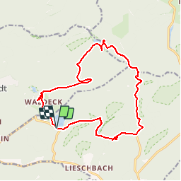


17.3 km | 24 km-effort

User


FREE GPS app for hiking
 SityTrail
IGN / Geographical institutes
SityTrail World
The world is yours!
Trail Walking of 16.1 km to be discovered at Grand Est, Moselle, Philippsbourg. This trail is proposed by tracegps.
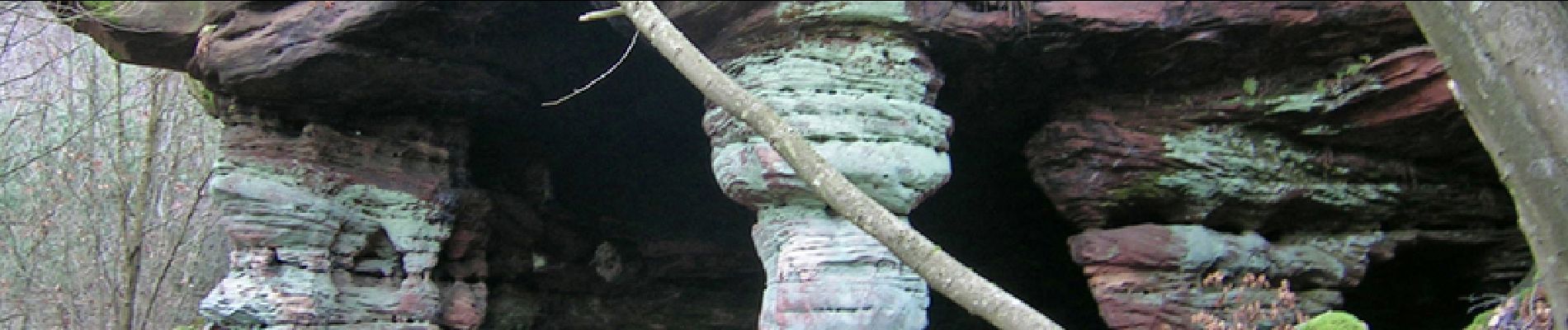
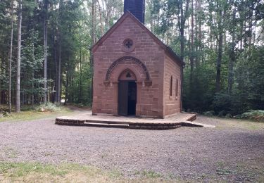
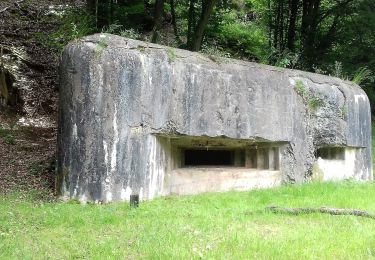
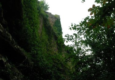
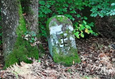
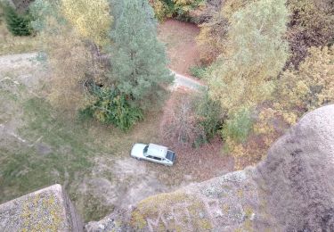
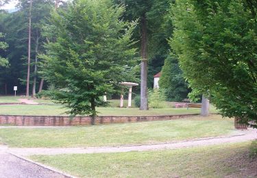
Quitter le parking de l’étang de Hanau en suivant le balisage croix bleue. Franchir la digue de l’étang (belle vue sur la ruine de Waldeck et sur le rocher de l’Erbsenfelsen). Col du Kachler. Étang de Lieschbach. Montée jusqu’aux ruines du château de Falkenstein (à voir : l’érosion alvéolaire qui attaque le très beau grès rose) (le château de Helfenstein se trouve à 150m à l’Est : non balisé). Continuer sur triangle jaune. Traverser route forestière de Landersberg. À 350m, km4,6 prendre à gauche le chemin balisé disque bleu. Ruine du Rothenbourg. Descendre un sentier en lacets. Parking de la Rothenbourg km7.3, vallée de la Altzinsel (ouvrages de la Ligne Maginot aquatique). Traverser la vallée en suivant balisage anneau rouge puis tourner à gauche. Arrivé à la digue de l’étang Erbsenweiher, suivre anneau jaune à droite sur 150 m, grotte du Erbsenthal (préhistoire). Revenir sur ses pas et traverser la digue sur anneau rouge (belle vue sur l’étang et le Biesenberg). Un chemin non balisé, à gauche, conduit à la chapelle Notre Dame des Bois à 200 m (datant du 16ème siècle et reconstruite en 1860). Revenir sur ses pas et continuer sur anneau rouge jusqu’à l’arrivée. Erbsenfelsen (crête rocheuse la plus impressionnante des Vosges du Nord avec arche naturelle de 12 m de long). Monter aux ruines du château de Waldeck. Revenir sur ses pas. Traverser le hameau de Waldeck. Sentier de découverte de la tourbière de Hanau (droséra : plante carnivore qui fleurit de juin à septembre). Étang de Hanau. Ce circuit fait partie du topoguide édité par l’association Club Vosgien de Bitche "Balades dans le Pays de Bitche", également disponible en allemand sous le titre "Wanderungen im Bitcherland". Toutes les infos sont ICI.


Walking
On foot
On foot
On foot
On foot
On foot