Trail Walking Serres - Autour du Pech Cardou - De Serres à Rennes-les-Bains - Photo

Autour du Pech Cardou - De Serres à Rennes-les-Bains

 tracegps
tracegps

User

© OpenStreetMap contributors
Length
Length
14.5 km
Max alt
Max alt
791 m
Uphill gradient
Uphill gradient
652 m
Km-Effort
Km-Effort  
23 km
Min alt
Min alt
268 m
Downhill gradient
Downhill gradient
651 m
Boucle
Boucle
Yes
Creation date :
2014-12-10 00:00:00.0
Updated on :
2014-12-10 00:00:00.0

(0 Reviews)

Walking
Walking
5h30
Difficulty : Medium

Scan this QR Code to open this trail in the SityTrail application

FREE GPS app for hiking

Logo SityTrail SityTrail

IGN / Geographical institutes

Download SityTrail from the App Store Download SityTrail from Google Play

Logo SityTrail SityTrail World

The world is yours!

Download SityTrail from the App Store Download SityTrail from Google Play Download SityTrail on Huawei AppGallery

About

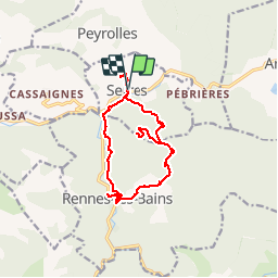
Trail Walking of 14.5 km to be discovered at Occitania, Aude, Serres. This trail is proposed by tracegps.

Description

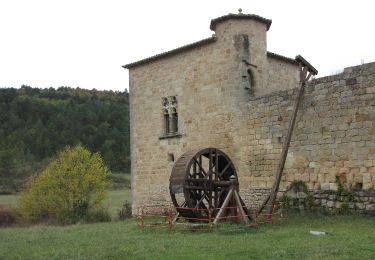
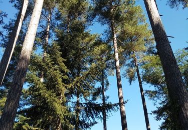
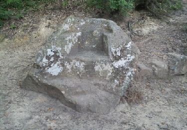
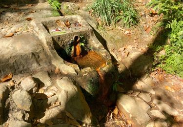
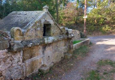
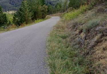
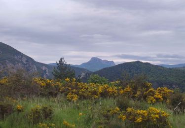
Cette sortie est organisée par Pierre. De Carcassonne prendre direction Limoux puis à Couiza tourner à gauche jusqu'à Serres. Avec presque 600m de dénivelé et 5h30 de marche, cette randonnée de 14.5 km est plutôt facile. Départ du village de Serres et montée directe au sommet du Pech Cardou puis descente en pente douce sur Montferrand par un chemin. On emprunte ensuite une petite route qui nous amène à Rennes-les-Bains. De là on rejoint Serres par un sentier agréable. On pousse jusqu'au château puis retour au parking.

Elevation profile

Photos

Points of interest

Point of interest Serres - 001-Parking Serres - Photo
tracegps
Point of interest Serres - 002-Pont typique - Photo
tracegps
Point of interest Rennes-les-Bains - 005-Pech Cardou - Photo
tracegps
RENNES-LES-BAINS 
Point of interest Rennes-les-Bains - 007-Halte repas - Photo
tracegps
RENNES-LES-BAINS 
Point of interest Rennes-les-Bains - 008-Lavoir - Photo
tracegps
RENNES-LES-BAINS 
Point of interest Rennes-les-Bains - 009-Rennes-les-Bains - Photo
tracegps
RENNES-LES-BAINS 
Point of interest Rennes-les-Bains - 011-Scultures bois - Photo
tracegps
RENNES-LES-BAINS 
Point of interest Serres - 012-Chateau de Serres - Photo
tracegps

Positioning

Country:
France
Region :
Occitania
Department/Province :
Aude
Municipality :
Serres
Location:
Unknown
Start:(UTM)
444872 ; 4755106 (31T) N.

Trails nearby

Trail Cycle Arques - CCS FFC Aude en Pyrénées - Circuit n°11 - Arques - Photo
Cycle
tracegps

Cycle

Difficult
(1)
Arques, Occitania, Aude, France
47 km | 60 km-effort
2h 30min
Yes
Trail On foot Arques - La Frau - Photo
On foot
PRO

On foot

Easy
Arques, Occitania, Aude, France
9.4 km | 13 km-effort
2h 57min
Yes
Trail On foot Arques - Les Berques - Photo
On foot
PRO

On foot

Easy
Arques, Occitania, Aude, France
6.7 km | 11.9 km-effort
2h 41min
No
Trail Walking Arques - Arques 29 09 3019 - Photo
Walking
mouma_77

Walking

Very easy
(2)
Arques, Occitania, Aude, France
8.6 km | 11.3 km-effort
3h 21min
Yes
Trail Walking Rennes-les-Bains - Sources Rennes les bains - Photo
Walking
patbt

Walking

Medium
(2)
Rennes-les-Bains, Occitania, Aude, France
5.8 km | 8.7 km-effort
3h 5min
Yes
Trail Walking Rennes-les-Bains - Rennes-les-Bains-le fauteuil du diable  - Photo
Walking
suresnois

Walking

Medium
Rennes-les-Bains, Occitania, Aude, France
12.2 km | 17.7 km-effort
4h 5min
Yes
Trail Walking Rennes-les-Bains - Rennes-les-Bains  le pech Cardou - Photo
Walking
suresnois

Walking

Medium
Rennes-les-Bains, Occitania, Aude, France
12.2 km | 19.7 km-effort
4h 37min
Yes
Trail Walking Serres - gogo1965 - Photo
Walking
gogo1965

Walking

Medium
Serres, Occitania, Aude, France
8.5 km | 11.7 km-effort
2h 7min
Yes
Trail Walking Serres - Sentier des Terres Rouges - Photo
Walking
cappelle

Walking

Medium
Serres, Occitania, Aude, France
12.5 km | 17.9 km-effort
4h 4min
Yes


Close
My subscriptions