


Cluny-Montbellet (par montagne)

phillux
User
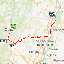

Length
37 km

Max alt
448 m

Uphill gradient
569 m
Km-Effort
45 km

Min alt
164 m

Downhill gradient
645 m
Boucle
No
Creation date :
2014-12-10 00:00:00.0
Updated on :
2014-12-10 00:00:00.0
--
Difficulty : Unknown

FREE GPS app for hiking
 SityTrail
IGN / Geographical institutes
SityTrail Plus
The world is yours!
About
Trail Cycle of 37 km to be discovered at Bourgogne-Franche-Comté, Saône-et-Loire, Cluny. This trail is proposed by phillux.
Positioning
Country:
France
Region :
Bourgogne-Franche-Comté
Department/Province :
Saône-et-Loire
Municipality :
Cluny
Location:
Unknown
Start:(Dec)
Start:(UTM)
627996 ; 5142558 (31T) N.
Comments