


Cascade de luizet

florent43
User
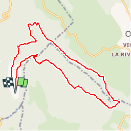

Length
10.5 km

Max alt
886 m

Uphill gradient
457 m
Km-Effort
16.6 km

Min alt
580 m

Downhill gradient
458 m
Boucle
Yes
Creation date :
2014-12-10 00:00:00.0
Updated on :
2014-12-10 00:00:00.0
--
Difficulty : Easy

FREE GPS app for hiking
 SityTrail
IGN / Geographical institutes
SityTrail Plus
The world is yours!
About
Trail Walking of 10.5 km to be discovered at Auvergne-Rhône-Alpes, Ain, Bénonces. This trail is proposed by florent43.
Positioning
Country:
France
Region :
Auvergne-Rhône-Alpes
Department/Province :
Ain
Municipality :
Bénonces
Location:
Unknown
Start:(Dec)
Start:(UTM)
693917 ; 5077452 (31T) N.
Comments
Les sentiers de cette randonnée ne sont plus praticables car pas entretenus. Dommage…