


Rando OTM 8 Mai 2012

gilbertdu60
User

Length
12.8 km

Max alt
239 m

Uphill gradient
327 m
Km-Effort
17.1 km

Min alt
47 m

Downhill gradient
324 m
Boucle
Yes
Creation date :
2014-12-10 00:00:00.0
Updated on :
2014-12-10 00:00:00.0
--
Difficulty : Difficult

FREE GPS app for hiking
 SityTrail
IGN / Geographical institutes
SityTrail Plus
The world is yours!
About
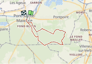
Trail Walking of 12.8 km to be discovered at Hauts-de-France, Oise, Pont-Sainte-Maxence. This trail is proposed by gilbertdu60.
Description
Parcours Rando 8 mai 2012 Office de Tourisme Maxipontain


Positioning
Country:
France
Region :
Hauts-de-France
Department/Province :
Oise
Municipality :
Pont-Sainte-Maxence
Location:
Unknown
Start:(Dec)
Start:(UTM)
471548 ; 5460965 (31U) N.
Comments