


Varade 2012-05-14

phila128
User

Length
23 km

Max alt
54 m

Uphill gradient
189 m
Km-Effort
25 km

Min alt
6 m

Downhill gradient
190 m
Boucle
Yes
Creation date :
2014-12-10 00:00:00.0
Updated on :
2014-12-10 00:00:00.0
4h44
Difficulty : Medium

FREE GPS app for hiking
 SityTrail
IGN / Geographical institutes
SityTrail Plus
The world is yours!
About
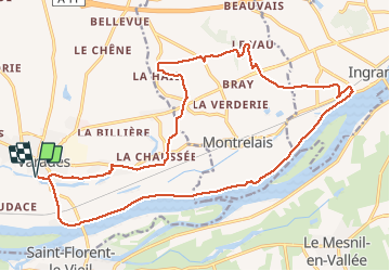
Trail Walking of 23 km to be discovered at Pays de la Loire, Loire-Atlantique, Loireauxence. This trail is proposed by phila128.
Positioning
Country:
France
Region :
Pays de la Loire
Department/Province :
Loire-Atlantique
Municipality :
Loireauxence
Location:
Varades
Start:(Dec)
Start:(UTM)
648663 ; 5249427 (30T) N.
Comments
Bien suivre le tracé et pas le balisage. On monte sur le coteau mais pas de belle vue. Retour le long de la Loire sur chemin goudronné.