


saint jean frapotel

gilbertdu60
User
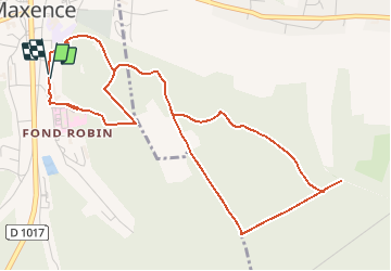

Length
5.7 km

Max alt
135 m

Uphill gradient
151 m
Km-Effort
7.8 km

Min alt
41 m

Downhill gradient
152 m
Boucle
Yes
Creation date :
2014-12-10 00:00:00.0
Updated on :
2014-12-10 00:00:00.0
--
Difficulty : Easy

FREE GPS app for hiking
 SityTrail
IGN / Geographical institutes
SityTrail Plus
The world is yours!
About
Trail Walking of 5.7 km to be discovered at Hauts-de-France, Oise, Pont-Sainte-Maxence. This trail is proposed by gilbertdu60.
Description
rue saint jean, croix frapotel
Positioning
Country:
France
Region :
Hauts-de-France
Department/Province :
Oise
Municipality :
Pont-Sainte-Maxence
Location:
Unknown
Start:(Dec)
Start:(UTM)
471353 ; 5460546 (31U) N.
Comments