Nord sur Erdre 2012-05-16

phila128
User

Length
18.1 km

Max alt
18 m

Uphill gradient
95 m
Km-Effort
19.4 km

Min alt
2 m

Downhill gradient
94 m
Boucle
Yes
Creation date :
2014-12-10 00:00:00.0
Updated on :
2014-12-10 00:00:00.0
3h27
Difficulty : Medium

FREE GPS app for hiking
 SityTrail
IGN / Geographical institutes
SityTrail Plus
The world is yours!
About
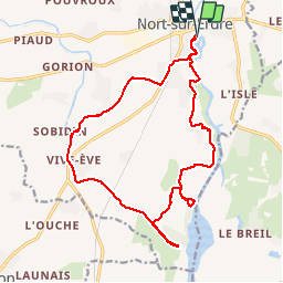
Trail Walking of 18.1 km to be discovered at Pays de la Loire, Loire-Atlantique, Nort-sur-Erdre. This trail is proposed by phila128.
Description
Marche le long de l'Erdre puis du canal de Nantes à Brest. Très sympa. Attention signalisation aléatoire.
Positioning
Country:
France
Region :
Pays de la Loire
Department/Province :
Loire-Atlantique
Municipality :
Nort-sur-Erdre
Location:
Unknown
Start:(Dec)
Start:(UTM)
613459 ; 5254853 (30T) N.
Comments