


Grand Som 2012-05-20

norbertmarteau
User

Length
8.9 km

Max alt
2008 m

Uphill gradient
886 m
Km-Effort
21 km

Min alt
1148 m

Downhill gradient
885 m
Boucle
Yes
Creation date :
2014-12-10 00:00:00.0
Updated on :
2014-12-10 00:00:00.0
4h45
Difficulty : Difficult

FREE GPS app for hiking
 SityTrail
IGN / Geographical institutes
SityTrail Plus
The world is yours!
About
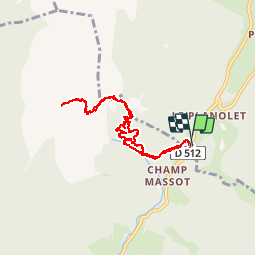
Trail Walking of 8.9 km to be discovered at Auvergne-Rhône-Alpes, Isère, Saint-Pierre-d'Entremont. This trail is proposed by norbertmarteau.
Positioning
Country:
France
Region :
Auvergne-Rhône-Alpes
Department/Province :
Isère
Municipality :
Saint-Pierre-d'Entremont
Location:
Unknown
Start:(Dec)
Start:(UTM)
721941 ; 5027462 (31T) N.
Comments