Trail Other activity Hermanville - 2012 - Etape 02 - Photo
© OpenStreetMap contributors
Length
Length
14.8 km
Max alt
Max alt
78 m
Uphill gradient
Uphill gradient
161 m
Km-Effort
Km-Effort  
16.8 km
Min alt
Min alt
9 m
Downhill gradient
Downhill gradient
126 m
Boucle
Boucle
No
Creation date :
2014-12-10 00:00:00.0
Updated on :
2014-12-10 00:00:00.0

(0 Reviews)

Other activity
Other activity
--
Difficulty : Unknown

Scan this QR Code to open this trail in the SityTrail application

FREE GPS app for hiking

Logo SityTrail SityTrail

IGN / Geographical institutes

Download SityTrail from the App Store Download SityTrail from Google Play

Logo SityTrail SityTrail World

The world is yours!

Download SityTrail from the App Store Download SityTrail from Google Play Download SityTrail on Huawei AppGallery

About

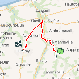
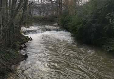
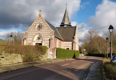
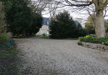
Trail Other activity of 14.8 km to be discovered at Normandy, Seine-Maritime, Hermanville. This trail is proposed by ehalle8544.

Description

Rallye touristique 2012 de Gonneville sur Scie - Tracé de la première étape.

Elevation profile

Positioning

Country:
France
Region :
Normandy
Department/Province :
Seine-Maritime
Municipality :
Hermanville
Location:
Unknown
Start:(UTM)
355142 ; 5520341 (31U) N.

Trails nearby

Trail Walking Gueures - Gueuues Ouville St Denis d'aclon - Photo
Walking
Papy Diouf

Walking

Medium
Gueures, Normandy, Seine-Maritime, France
8.4 km | 9.9 km-effort
1h 39min
Yes
Trail Walking Bertreville-Saint-Ouen - bertreville St ouen omonville bacqueville pierreville - Photo
Walking
Papy Diouf

Walking

Very easy
Bertreville-Saint-Ouen, Normandy, Seine-Maritime, France
11.1 km | 12.3 km-effort
1h 58min
Yes
Trail Walking Gueures - Gueures - Photo
Walking
Sylber

Walking

Medium
Gueures, Normandy, Seine-Maritime, France
10.2 km | 11.9 km-effort
3h 4min
Yes
Trail On foot Bacqueville-en-Caux - baqueville en caux - Photo
On foot
nicole.reine@wanadoo.fr

On foot

Medium
Bacqueville-en-Caux, Normandy, Seine-Maritime, France
12.3 km | 14.4 km-effort
Unknown
Yes
Trail Walking Avremesnil - Avremesnil - Photo
Walking
BaladesEN

Walking

Very easy
Avremesnil, Normandy, Seine-Maritime, France
8.9 km | 10.4 km-effort
2h 16min
Yes
Trail Cycle Thil-Manneville - 16 aout 2013 - Photo
Cycle
darnanville

Cycle

Easy
Thil-Manneville, Normandy, Seine-Maritime, France
32 km | 36 km-effort
3h 20min
Yes
Trail Equestrian Avremesnil - La Renardière - Le Bourg Dun - Photo
Equestrian
tracegps

Equestrian

Medium
Avremesnil, Normandy, Seine-Maritime, France
19.7 km | 22 km-effort
3h 30min
Yes
Trail Mountain bike Avremesnil - La Renardière - Le Bourg Dun - Photo
Mountain bike
tracegps

Mountain bike

Medium
(1)
Avremesnil, Normandy, Seine-Maritime, France
19.7 km | 22 km-effort
2h 0min
Yes
Trail Running Brachy - run normandie 1 - Photo
Running
remdmc

Running

Very easy
(1)
Brachy, Normandy, Seine-Maritime, France
12.4 km | 15.2 km-effort
Unknown
No


Close
My subscriptions