Trail Walking Saint-Clément - Du petit Goul au grand Goul - Saint Clément - Photo

Du petit Goul au grand Goul - Saint Clément

 tracegps
tracegps

User

© OpenStreetMap contributors
Length
Length
10.8 km
Max alt
Max alt
1130 m
Uphill gradient
Uphill gradient
339 m
Km-Effort
Km-Effort  
15.3 km
Min alt
Min alt
900 m
Downhill gradient
Downhill gradient
343 m
Boucle
Boucle
Yes
Creation date :
2014-12-10 00:00:00.0
Updated on :
2014-12-10 00:00:00.0

(1 Reviews)

Walking
Walking
3h00
Difficulty : Medium

Scan this QR Code to open this trail in the SityTrail application

FREE GPS app for hiking

Logo SityTrail SityTrail

IGN / Geographical institutes

Download SityTrail from the App Store Download SityTrail from Google Play

Logo SityTrail SityTrail World

The world is yours!

Download SityTrail from the App Store Download SityTrail from Google Play Download SityTrail on Huawei AppGallery

About

Trail Walking of 10.8 km to be discovered at Auvergne-Rhône-Alpes, Cantal, Saint-Clément. This trail is proposed by tracegps.

Description

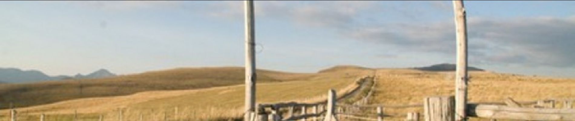
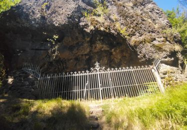
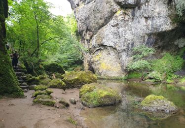
La rivière Goul prend sa source à 1400 m d'altitude environ sur la commune de Saint Clément. Terre d'estive, comme Pailherols et Badailhac, ici aussi on retrouve la tradition pastorale et les burons ou fermes d'altitude. Circuit inscrit au Plan départemental des Itinéraires de Petites Randonnées. Départ : place de l'église et de la mairie de St Clément. Chiens déconseillés, en raison des troupeaux de vaches en pâture.

Elevation profile

Photos

Positioning

Country:
France
Region :
Auvergne-Rhône-Alpes
Department/Province :
Cantal
Municipality :
Saint-Clément
Location:
Unknown
Start:(UTM)
473287 ; 4980219 (31T) N.

Comments

Please log in to post a review or rate the element


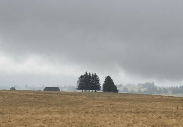
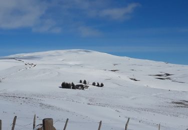
Belle balade avec le soleil et la neige et de jolis chemins


Trails nearby

Trail Walking Thiézac - La Porte du Lion - Thiézac - Photo
Walking
tracegps

Walking

Medium
(2)
Thiézac, Auvergne-Rhône-Alpes, Cantal, France
6.6 km | 10.5 km-effort
3h 0min
Yes
Trail Walking Thiézac - La porte du Lion - Thiézac - Photo
Walking
tracegps

Walking

Medium
(2)
Thiézac, Auvergne-Rhône-Alpes, Cantal, France
7.6 km | 11.5 km-effort
3h 30min
Yes
Trail Walking Pailherols - Pailherols chapelle du Cantal  - Photo
Walking
GUIDE
antignacs

Walking

Medium
Pailherols, Auvergne-Rhône-Alpes, Cantal, France
21 km | 29 km-effort
5h 29min
Yes
Trail Walking Vic-sur-Cère - Pas de Cère- cascade de Gourdole - Photo
Walking
crocau

Walking

Very easy
Vic-sur-Cère, Auvergne-Rhône-Alpes, Cantal, France
4.7 km | 6.6 km-effort
2h 0min
Yes
Trail Walking Thiézac - Puy de la poche  - Photo
Walking
nadd73

Walking

Easy
Thiézac, Auvergne-Rhône-Alpes, Cantal, France
13.1 km | 23 km-effort
3h 14min
Yes
Trail Walking Thiézac - Les Gorges du Pas de Cère - Photo
Walking
VacheKiri67

Walking

Easy
Thiézac, Auvergne-Rhône-Alpes, Cantal, France
4.8 km | 6.8 km-effort
2h 21min
Yes
Trail Walking Pailherols - rando sentier des  gentianes - Photo
Walking
Sandrine 15

Walking

Medium
Pailherols, Auvergne-Rhône-Alpes, Cantal, France
13.1 km | 17.7 km-effort
3h 20min
Yes
Trail Walking Jou-sous-Monjou - Cantal - Jou sous Monjou - 7.7km 300m 2h40 - 2019 06 27 - Photo
Walking
Orcal37

Walking

Easy
Jou-sous-Monjou, Auvergne-Rhône-Alpes, Cantal, France
7.7 km | 11.7 km-effort
2h 40min
Yes
Trail Walking Pailherols - Du refuge des Fraux au Plomb du Cantal - Photo
Walking
tracegps

Walking

Difficult
Pailherols, Auvergne-Rhône-Alpes, Cantal, France
22 km | 32 km-effort
7h 0min
Yes


Close
My subscriptions