


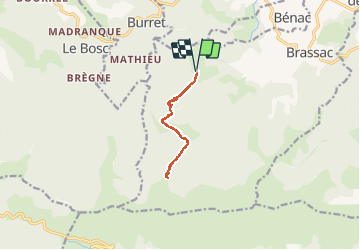
Cabane de la Devèze - Legrillou

tracegps
User

Length
9.7 km

Max alt
1513 m

Uphill gradient
576 m
Km-Effort
17.4 km

Min alt
946 m

Downhill gradient
574 m
Boucle
Yes
Creation date :
2014-12-10 00:00:00.0
Updated on :
2014-12-10 00:00:00.0
1h30
Difficulty : Easy

FREE GPS app for hiking
 SityTrail
IGN / Geographical institutes
SityTrail Plus
The world is yours!
About
Trail Walking of 9.7 km to be discovered at Occitania, Ariège, Brassac. This trail is proposed by tracegps.
Description
Départ du Col de Légrillou, du parking prendre le chemin à gauche et suivre le fléchage jaune.
Photos

Positioning
Country:
France
Region :
Occitania
Department/Province :
Ariège
Municipality :
Brassac
Location:
Unknown
Start:(Dec)
Start:(UTM)
377465 ; 4755367 (31T) N.
Comments