Trail Walking Artaise-le-Vivier - Stonne et le Pain de Sucre - Photo

Stonne et le Pain de Sucre

 tracegps
tracegps

User

© OpenStreetMap contributors
Length
Length
16.4 km
Max alt
Max alt
338 m
Uphill gradient
Uphill gradient
293 m
Km-Effort
Km-Effort  
20 km
Min alt
Min alt
182 m
Downhill gradient
Downhill gradient
296 m
Boucle
Boucle
Yes
Creation date :
2014-12-10 00:00:00.0
Updated on :
2014-12-10 00:00:00.0

(0 Reviews)

Walking
Walking
3h15
Difficulty : Difficult

Scan this QR Code to open this trail in the SityTrail application

FREE GPS app for hiking

Logo SityTrail SityTrail

IGN / Geographical institutes

Download SityTrail from the App Store Download SityTrail from Google Play

Logo SityTrail SityTrail World

The world is yours!

Download SityTrail from the App Store Download SityTrail from Google Play Download SityTrail on Huawei AppGallery

About

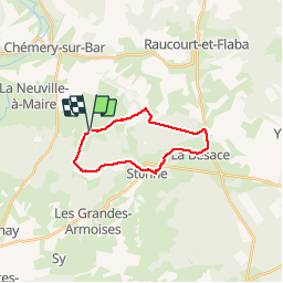
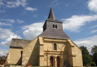
Trail Walking of 16.4 km to be discovered at Grand Est, Ardennes, Artaise-le-Vivier. This trail is proposed by tracegps.

Description

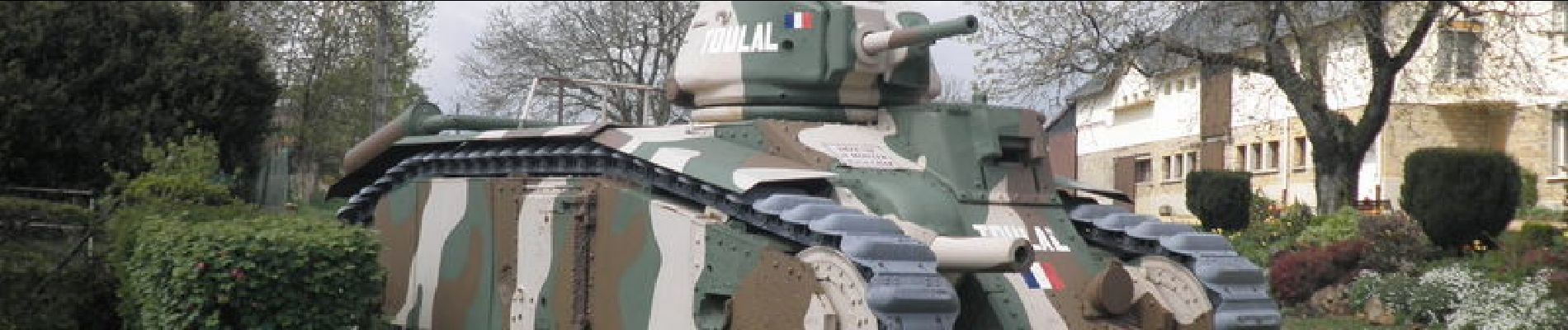
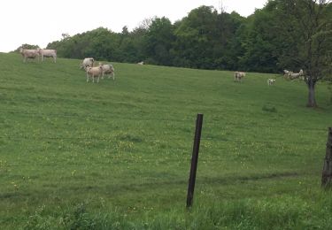
Entre prairies et forêts, ce circuit vous fait visiter un lieu où il y eu en mai 1940 de très sanglants combats. Vous marcherez en partie sur la voie romaine Reims Trève et aurez un magnifique panorama du haut du "pain de sucre" de Stonne.

Elevation profile

Photos

Positioning

Country:
France
Region :
Grand Est
Department/Province :
Ardennes
Municipality :
Artaise-le-Vivier
Location:
Unknown
Start:(UTM)
636711 ; 5492163 (31U) N.

Trails nearby

Trail Walking Le Mont-Dieu - Le Mont Dieu - Photo
Walking
PascalBanide

Walking

Easy
(2)
Le Mont-Dieu, Grand Est, Ardennes, France
9.5 km | 12.4 km-effort
2h 18min
Yes
Trail Walking Chémery-Chéhéry - De Chémery-sur-Bar à La Neuville via Vendresse - Photo
Walking
tracegps

Walking

Difficult
Chémery-Chéhéry, Grand Est, Ardennes, France
15.9 km | 18.2 km-effort
5h 0min
Yes
Trail Mountain bike Les Grandes-Armoises - Circuit des Grandes Armoises à Sy - Photo
Mountain bike
tracegps

Mountain bike

Easy
Les Grandes-Armoises, Grand Est, Ardennes, France
12.7 km | 15.9 km-effort
1h 19min
Yes
Trail Walking Les Grandes-Armoises - Circuit des Grandes Armoises à Sy - Photo
Walking
tracegps

Walking

Difficult
Les Grandes-Armoises, Grand Est, Ardennes, France
12.7 km | 15.9 km-effort
3h 30min
Yes
Trail Walking Raucourt-et-Flaba - prom - Photo
Walking
ycaille

Walking

Medium
Raucourt-et-Flaba, Grand Est, Ardennes, France
7 km | 9 km-effort
1h 26min
Yes
Trail Walking Raucourt-et-Flaba - de artaise à Maisoncelle 29 - Photo
Walking
veromonf

Walking

Easy
Raucourt-et-Flaba, Grand Est, Ardennes, France
14.8 km | 17.9 km-effort
3h 13min
Yes
Trail Walking Le Mont-Dieu - Les grandes Armoises - Photo
Walking
DoBelle

Walking

Very easy
Le Mont-Dieu, Grand Est, Ardennes, France
19.5 km | 26 km-effort
4h 39min
No
Trail Walking Tannay - rando - Photo
Walking
Tommy Eric

Walking

Very difficult
Tannay, Grand Est, Ardennes, France
19.3 km | 24 km-effort
4h 5min
No
Trail Walking Chémery-Chéhéry - chemery - Photo
Walking
lousim22

Walking

Difficult
Chémery-Chéhéry, Grand Est, Ardennes, France
13.6 km | 17.8 km-effort
3h 19min
No


Close
My subscriptions